
Subscribe

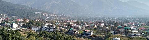
Dharamshala, the second capital of Himachal Pradesh, at an altitude of 1,250-1,500 metres is in Zone V of India’s earthquake hazard zoning map — those at the highest risk, with intensity IX or greater on the Medvedev–Sponheuer–Karnik scale.
The altitude of the city is 1,250-1,550 metres. It is located in Zone V (highest risk zone with intensity IX or greater on the Medvedev–Sponheuer–Karnik scale) in the earthquake hazard zoning map of India.
Due to large differences in slope between different parts of the city, it has been divided into upper and lower Dharamshala, which makes it more susceptible to critical hazards like landslides.
Dharamshala has a slope varying from gentle to steep, depending on different parts of the city.
|
Source: Dimple Behal
Landslides are one of the most frequent hazards that occur in Dharamshala. Almost every year, the city is liable to be hit by severe landslides, especially during the rainy season and after high-intensity earthquakes.
The city, headquarters of the Kangra district, lies south-west of the Dhauladhar range. The vulnerability of the geologically young steep slopes of Dhauladhar has increased because of anthropogenic activities and illegal construction due to the lack of availability of land.
Increasing urbanisation, deforestation and encroachment of areas at high hill slopes, unscientific road cutting and water-intensive agricultural practices contributed to the increase in intensity and frequency of landslides. The situation is worse during the monsoon when landslide-prone areas are washed away due to exposure.
Several field investigations have been carried out after landslides to grasp an overall view.
All of Dharamshala is prone to landslides, while land with slopes higher than 25 per cent need major attention.
The greatest number of wards in Dharamshala have 0-15 per cent slope, while every ward is developed with almost the same population irrespective of terrain constraints.
Past landslides and loss of infrastructure
|
Source: Dimple Behal
This means construction is high even in areas vulnerable to landslides. This is due to the demand for living within the city. It is not just the difference between slopes, but also anthropogenic causes that lead to the emergence of hazards like landslides.
The Dharamsala-Mcloedganj road is the most vital road connecting upper and lower Dharamshala. It is also known as an ‘active sliding zone’.
There are four portions on the road where it sinks:
During the peak tourist season, the road is marred with traffic jams due to continuous sinking.
Several factors have continuously contributed to an increase in the road’s vulnerability. The first is Illegal construction and uncontrolled leveling of hillocks along the roads.
Hillocks are flattened to accommodate housing projects, commercial establishments, etc. The informal sector often starts residing in these areas which are more vulnerable to risks. These areas have comparatively lower land values and fewer people come to settle here.
The second is a loss in green cover, something that occurs as more people reside within the city, increasing soil erosion, risking further vulnerability to landslides.
Due to loss of green cover and steep gradient of the slope, water is not absorbed in soil and washed away very quickly.
The third is the unscientific manner of cutting hills for widening roads and construction. This causes sinking of roads, which affects road width and causes traffic interruptions. This can be seen when caving hillsides, something that began after excavating a 40 feet portion of the Dharamshala-Kangra road.
The fourth is the absence of a sewerage system in the area. The surface character of Mcloedganj comprises of sandstone, claystone and loose soil at the bottom, middle and top layers respectively, with no water-retaining capacity.
Due to unavailability of sewerage systems, people construct septic tanks that are unsafe for soil strata. Water from septic tanks drains to the upper layer of soil that has loose soil, making areas more vulnerable to damage from landslides.
The vulnerability of the city has not increased because of geomorphologic characteristics, but because of anthropogenic causes.
Unplanned and massive constructions are carried on in areas that fall in active landslide zones in the Dharamshala region. The state government and the district administration have done nothing to regulate and check construction in active sliding zones.
Till date, the Public Works Department and other authorities have not come up with a comprehensive policy and plan to check landslide threats to public and private infrastructure.
Similar conditions can be seen in other hilly cities where unplanned development takes its toll on lives and infrastructure. To avoid such causalities, comprehensive plans and policies should be prepared at the local level to deal with such hazards.
