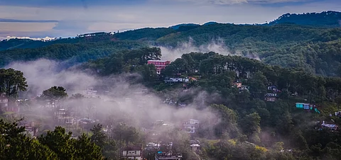

Meghalaya in northeastern India translates to the ‘Abode of Clouds’ because of the near permanent presence of clouds and accompanying rain. Two of the rainiest places in the world, Mawsynram and Cherrapunji are also in the state where 83 per cent of the population is dependent on rain-fed agriculture and 48 per cent of the land is cultivable.
The current monsoon, recent and even long-term trends suggest a rethinking of the name and poses a concern for the livelihood and water security of many regions of the state.
During the Southwest Monsoon (SWM) season of 2025, the state has the highest rainfall deficit among all the states and Union Territories (UT) of the country at 56 per cent. Even in terms of absolute rainfall, Meghalaya has received less rainfall than a much drier state like Jharkhand.
In fact, a total seven states and Union territories have received more absolute rainfall than Meghalaya in the SWM season 2025. Among these, only Goa normally receives more rainfall than Meghalaya for the period.
SPI values and their interpretation:
SPI Rainfall Intensity
>2 Extremely wet
1.50 - 1.99 Very wet
1.00 - 1.49 Moderately wet
-0.99 - 0.99 Near normal
-1.00 - -1.49 Moderately dry
-1.50 - -1.99 Severe dry
Between June 1 and July 28, Meghalaya received 690.7 millimetres (mm) of rainfall against a normal of 1,555.4 mm. In contrast, Jharkhand received 732.6 mm rainfall against a normal of 478.3 mm which amounts to an excess of 53 per cent.
Jharkhand’s excess rainfall percentage is the fourth-highest in the country, behind the cold desert region of Ladakh as well as Rajasthan and mostly semi-arid Madhya Pradesh.
The drying trend in the state also shows up in long term trends, some of which are over a century long. According to a research paper published in the Journal of the Indian Society of Remote Sensing in July 2022, the central parts of Meghalaya received more rain than other parts of the state in the decade 1951-1960.
With passage of time, the drier areas in the state increased in size, especially in the western, central and northern regions. The analysis was carried out by scientists from the irrigation and drainage department of the College of Agricultural Engineering and Post-Harvest Technology, Central Agricultural University, Sikkim.
The paper analysed the decadal variation of rainfall between 1951 and 2020 over annual, monthly and seasonal timescales in Meghalaya using the Standard Precipitation Index (SPI). The SPI measures the deviation of observed rainfall from the long term average for a specific region over a particular time period.
Among months, the scientists chose December and among seasons, they chose the post monsoon season that they define as October to February (different from the official October to December definition of India Meteorological Department (IMD)). The reason for choosing December was the historically meagre rains received by Meghalaya in that month. The study authors chose the post monsoon season because many of the local crops are harvested in those months.
The study found that in recent decades, the wetter regions in the state were in the southern and southeastern parts of the state — East Khasi Hills and Jaintia Hills. The highest rainfall has been recorded in the Southwest Khasi Hills.
An analysis of rainfall during the southwest monsoon season between 1989 and 2018 conducted by IMD showed Meghalaya as one of the five states having experienced a significant decreasing trend in rainfall during the season. The other four states were Nagaland, West Bengal, Bihar and Uttar Pradesh.
The same five states, along with Arunachal Pradesh and Himachal Pradesh, also show a significant decreasing trend in annual rainfall during the same period. The analysis was highlighted by a Union Ministry of Earth Sciences response to a query in the Lok Sabha and was subsequently published as a Press Information Bureau press release on July 26, 2023.
For Cherrapunji, currently the second rainiest place in the world, the trend of rainfall over a period of 135 years from 1872 to 2007, shows a decreasing trend in seven of the 12 months — February, March, April, May, June, August and September. This is according to a research paper published in the Journal of Applied and Natural Science in February 2021, by Surobhi Deka of the department of statistics, Cotton University, Guwahati.
While the absolute rainfall in Meghalaya may remain higher than other areas in the larger region of northeast India, the decreasing trend may impact the rich fauna and flora of the state used to the high intensity of rains year after year and monsoon after monsoon. The state is part of the Indo-Burma biodiversity hotspot, which is one of four in India and 34 in the world. More research is required to ascertain the impacts of decreased rainfall on various species and also on the livelihood of the farmers of Meghalaya.
Such decreasing trends in annual and seasonal rainfall over decades and even in some of the rainiest of places, put into focus the impact of global warming and consequent climate change on the rainfall patterns in agriculture dependent and biodiversity rich regions like Meghalaya.