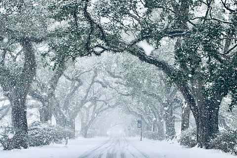

January 21, 2025, marked an unprecedented weather event as the first-ever blizzard warning was issued for the Gulf Coast of the United States. The severe unprecedented snowstorm, named ‘Enzo,’ was driven by an unusually strong and stretched out Arctic polar vortex, and has left meteorologists and climate scientists astounded by its intensity and reach.
The storm follows closely on the heels of devastating wildfires in Los Angeles city, which were fuelled by ‘hydro-climate whiplash’.
The snowstorm and severe winter weather in the southeast US contrast sharply with the rest of the world, which is experiencing higher-than-average minimum and maximum temperatures.
Snow accumulation, including on beaches, shattered long-standing records in Gulf Coast states such as Louisiana, Florida, and Texas, some of which date back nearly 200 years. In certain areas, such as New Orleans, snowfall far exceeded forecasts issued by the US National Weather Service (NWS).
Meteorologists, climate scientists, and other observers are stunned by the magnitude and intensity of the snowstorm, describing it as a “once in a generation event” and “beyond imagination.”
Some of the regions impacted by the snow storms were also affected by many of the hurricanes, such as Helene and Milton, during the 2024 hurricane season, demonstrating the unpredictability and continuity of the impacts of global warming and consequent climate change in the region.
The NWS office in Lake Charles, Louisiana, issued a blizzard warning for at least nine counties in the state from the morning of January 21 to noon on the same day. According to the NWS, this is the first time it has happened.
A blizzard warning indicates that frequent wind gusts of up to 35 miles per hour (56 kilometres per hour) and snow will reduce visibility to one fourth of a mile (1.6 km) or less, according to NWS. The rest of the Gulf Coast was also under winter storm warnings of varying intensities.
“Arctic air will filter south and east through early this week. As this cold air moves across the south, a rare winter storm is forecast to develop from Texas, Gulf Coast states into the southeast through early this week. Several new daily record low temperatures are expected, including new record-low maximum temperatures”, predicted NWS on X (formerly Twitter).
The following are the highest snow accumulations recorded across US states as of 11.30 pm EST on January 21, according to private weather and climate information platform The Weather Channel (TWC):
Louisiana: 11.5 inches or 29.21 centimetres in Chalmette (near New Orleans)
Alabama: 11 inches or 27.94 cm in Babbie, southeast Alabama
Mississippi: 9 inches or 22.86 cm in Ocean Springs
Florida: 8.8 inches or 22.352 cm in Milton (north of Pensacola)
Georgia: 7 inches or 17.78 cm in Blakely and Leesburg
Texas: 6 inches or 15.24 cm near Pine Island (near Beaumont)
South Carolina: 3 inches or 7.62 cm near Conway
“New Orleans nearing the end of the worst winter storm in the city’s history with records almost 200 years old,” wrote meteorologist Ryan Maue on X.
The storm brought 7.5 inches or 19.05 cm of snow to Mobile city, Alabama. This is “the most the Gulf Coast city has seen for any snow event on record dating to the late 1800s,” according to TWC.
The city of Milton in Florida received 8.8 inches (22.35 cm) of snow, which is a state record and more than double the previous record of 4 inches (10.16 cm) set on March 6, 1954, according to TWC.
The exceptional snowfall was linked to atmospheric disturbances thousands of kilometres apart. The first cause was the Arctic polar vortex — a mass of cold air typically confined to the region by a strong jet stream. An undulating tropospheric polar vortex is a common wintertime phenomenon, but the undulations — and the resulting storms — have become much more severe in recent years.
“The polar vortex is a stream of cold air that normally circles the Arctic. Normally contained by a strong jet stream, this ring of frigid arctic air can become unstable when the jet stream weakens, allowing it to spill southward,” according to the National Oceanic and Atmospheric Administration (NOAA).
This time, however, the scenario was slightly different. This winter, the vortex strengthened and stretched unusually far south, enabling Arctic air to spill into the Gulf Coast and bring in the extreme snowstorm in the southeast US.
“The polar vortex strength, as measured by the speed of the winds around the 60 N latitude circle and 10 hectopascal pressure level, remains stronger than average, and is currently forecast by most models to return to near-record strong wind speeds into early February”, said NOAA on its polar vortex blog.
“However, in this case, the vortex is actually forecast to stretch throughout its entire depth (10-30 miles above the surface) over Canada and the Hudson Bay,” according to NOAA. “The stretched-out polar vortex may be associated with the forecasted southward shift of the jet stream, which allows the troposphere’s cold Arctic air to spill into the continental US,” it added.
The presence of a stretched-out polar vortex in conjunction with a snowstorm does not necessarily imply that it is the immediate cause, NOAA underlined. It also identified a high atmospheric pressure area developing over Alaska as a likely cause of the extreme snowfall, independent of the jet stream and polar vortex.