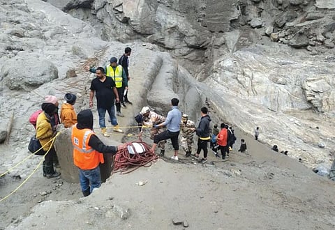

The Himalayas are an ecological system naturally primed for calamities. First, being the youngest mountain range in the world, they are highly prone to erosion. Due to continuous upliftment of the mountain, the region falls in a very high seismic zone, and its rivers cut the rocks deeply. Bank erosion is also extensive wherever the rivers take a sinuous course. Add to this rainstorms and cloud bursts that lash these mountains. Together, these factors form a setting extremely susceptible to natural disasters like earthquakes, landslides, subsidence, floods, snow avalanches and even cloud bursting and forest fires. An analysis of data available on the EM-DAT international disaster database, shows that the Himalayan states and union territories—Ladakh, Jammu and Kashmir, Himachal Pradesh, Uttarakhand, Arunachal Pradesh, Manipur, Meghalaya, Mizoram, Nagaland, Sikkim, Tripura and Assam— stretching across 2,500 km, account for 18 per cent of the country’s geographical area, but have experienced 35 per cent of the major disasters over the last 110 years. The analysis does not include West Bengal because only one of its 23 districts is on the Himalayas. Of the 687 disasters that the country experienced between 1900 and 2022, as many as 240 were in the Himalayas. Consider landslide incidents. Between April 2021 and April 2022, the Geological Survey of India recorded 41 such events across the country.
Of these, all but three occurred in Himalayan states. Sikkim saw the highest number of landslide incidents—11, primarily in the months of May and June. Meghalaya recorded eight, Arunachal Pradesh followed closely at six while Himachal Pradesh recorded five. According to NASA’S landslide reporter data, the region has experienced 1,121 landslide events between 2007 and 2017. A closer look at the data shows an uncomfortable trend. In recent decades, these disasters are occurring more frequently and getting more severe, causing a significant loss of life and damage to property. In the first six decades of the last century (1902–1962), the region recorded only five disasters. Since then, there has been a rapid decade-on-decade increase in disasters. In 1963-1972, the region reported 11 disasters, followed by 13 disasters in 1973-82. The last decade (2013-2022) saw the highest number of disasters at 68, and they accounted for 44 per cent of all the disasters reported in India.
Floods are the most common type of disaster in the region, accounting for 132 of the 240 disasters recorded since 1903. It is followed by landslides (37), extreme temperature (20) and 17 earthquakes. Floods (36) have remained the most common disaster type even in the last decade (2013-2022), followed by thunder and cyclonic storms, landslides and earthquakes. While EM-DAT is the only database that provides such information since the 1900s, it records only major disasters, defined as those that have either recorded 10 or more deaths, affected 100 or more people, led to the declaration of a state of emergency, or called for international assistance.
This means it does not capture events where houses and roads are developing major cracks, subsidence has been reported, but no deaths have been recorded so far. A similar trend can also be seen in earthquakes. The National Center for Seismology, under the Union Ministry of Earth Sciences, the Himalayan states have recorded 2,687 earthquakes between 2009 and 2021, but the majority of the events were of low intensity. While no systematic study has been undertaken to ascertain the reasons for such growing instances of disasters across the Himalayas, all evidence point to the unfettered and unplanned infrastructure projects in the region that is already warming faster than the rest of the country and is highly vulnerable to climate change. It is time we joined the dots and called a spade a spade.
This was first published in the State of India's Environment 2024