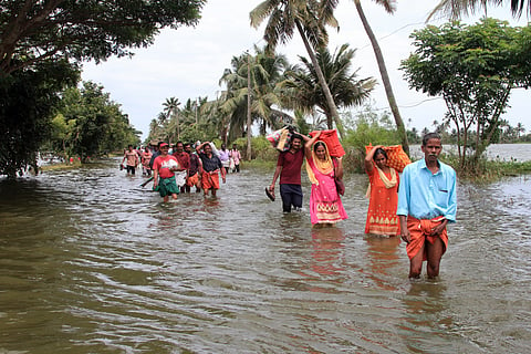
Kerala: Community-oriented flood forecast system launched in disaster-prone Periyar, Chalakudi river basins
This story has been updated
A unique decentralised, community-oriented, and impact-based flood forecast and early warning system has been developed for the Periyar and Chalakudy river basins of Kerala, pioneering a new approach to disaster management in the country.
This innovative system, launched on September 28, 2024, at Ernakulam District Collectorate, aims to help administrators understand increasingly severe annual weather events, particularly floods, caused by climate change and exacerbated by numerous anthropogenic factors.
In the aftermath of the devastating deluge of 2018, the Periyar and Chalakudy river basins have been witnessing recurring floods, which have inundated multiple human settlements and continue to pose a significant threat to life and property. These looming threats calls for better technologies and approaches to disaster management.
The program was inaugurated by V D Satheesan, opposition leader, who also launched the website “insight-gather”. It is a part of the Project Community-Sourced Impact-based Flood Forecast and Early Warning System (CoS-it-FloWS) by Equinoct, a Kochi-based community-sourced modelling solution provider, in collaboration with the Community Resource Centre (CRC) in Puthanvelikkara, Resilient Destinations Foundations and the Ernakulam District Disaster Management Authority.
Project CoS-it-FloWS
Under the newly launched climate information system, data collected on a daily basis from 100 rain gauges operated with community participation across the Periyar and Chalakudy river basins will be available to the Ernakulam District Emergency Operation Centre (EOC) for improved disaster planning. This will help in taking informed decisions during emergencies.
This collective initiative significantly enhances flood disaster preparedness, mitigation, rescue, and rehabilitation in the two crucial river basins, prompting other vulnerable areas in the country to replicate the model.
“Now we have developed a community-sourced impact-based flood forecast and warning system that can be replicated in other vulnerable areas of the country and similar data-sparse countries of the Global South,” C Jayaraman, one of the key functionaries of the tech startup and a Kochi-based energy management expert, told Down To Earth (DTE).
Large-scale hyper-local data mobilisation is one of the project’s hallmarks. The monitoring stations are operated with the help of a dedicated community volunteer network. A Mobile application named “gather” has also been developed to help transmit the community-gathered data.
Mobile app for data collection
To strengthen the facility, Equinoct has also developed a novel rain gauge suited to measuring extreme rainfall events, and a “climate dashboard” that displays data collected by community volunteers and various organisations across the river basins. Along with the visual representations, this dashboard will help collate, analyse, and display multiple data sets on climate and water-related variables. This can be extremely useful to the administration and other government agencies for informed decision-making regarding disaster preparedness and issuing early warnings during potential disasters.
Jayaraman said using the facility can help bridge data gaps and has the provisions for simulating various parameters to create impact-based forecasting. These facilities are expected to enhance effective rescue and rehabilitation during extreme weather events.
“An early warning system that uses hyper-local data to address the current gaps, challenges, and uncertainties in flood forecasting is essential for protecting lives, properties, and livelihoods. This system can help the administration take prompt, well-informed action during emergencies. The limitations of existing monitoring systems, the absence of impact-based forecasts, and significant gaps in last-mile connectivity undermine the effectiveness of early warning systems in India,” C G Madhusoodhanan, one of the founders of Equinoct, told DTE.
“At the moment, flood forecasting in different locations in the country faces different challenges. There is a lack of detailed flood inundation maps for different weather and river conditions and insufficient local flood action plans for the affected communities and disaster management authorities,” he added.
Madhusoodhanan further explained that the situation is especially complicated in the small, humid tropical river basins in the Western Ghats, where the contribution of groundwater to floods is significant but not well understood. “Most current hydrological models underestimate flood volumes and runoff,” he said. “The data on rainfall, river, tidal, and groundwater levels, primarily collected by students, women, and youth at the household level using manual gauges, are gathered through our mobile app or collated by partnering community organisations,” he added.
Talking about the sheer scale of community participation, Jayaraman stated that the project involves community members from different backgrounds and geographical locations including seven-year-old Ivana, nine-year-old Elna, and 81-year-old retired professor Vimala Devi.
CoS-it-FloWS aims to bridge the connectivity and data gaps at the last mile while providing innovative and inclusive solutions to address climate risks. To accomplish this, it is necessary to empower neighbourhood communities to create hyper-local monitoring systems, develop hydrological models, and develop AI modules to lessen flood inundation mapping and forecasting uncertainties.
Additionally, the initiative aims to develop impact-based warning systems and co-create science-based solutions and decision support systems for disaster risk reduction with communities.
Meanwhile, Jayaraman stated that in the next phase, the system will be tested during an actual disaster to analyse the dependability of the data. “It will be further fine-tuned by correcting any mistakes. With government support, the system can be scaled up further by making hourly updates available instead of daily reports,” he said.

