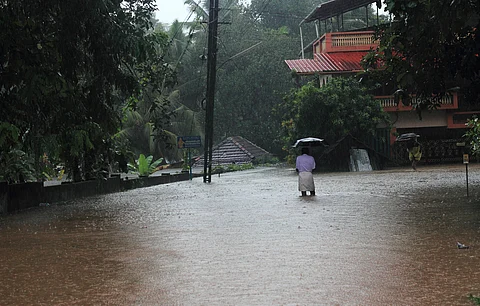

The sobering visuals of entire villages washed away in the Wayanad landslide that claimed over 300 lives in the Kerala district has been a clarion call for the entire country to address the persisting climate crisis. Experts are ascribing the disaster to intensifying monsoon rains and land-use change favouring plantations over forests. But the role of a more ‘invisible’ atmospheric event cannot be overlooked.
Humid heat in summers and heavy rainfall during the monsoon is usual for the subcontinent but the intensity of both has palpably increased in recent years. The monsoon months from July-September have become wetter, along with erratic precipitation patterns as the world warmed.
In the last five years, for instance, the number of stations receiving ‘very heavy’ and ‘extremely heavy rainfall’ in July has more than doubled across the country, hitting a high of 1,113 and 205, respectively, in 2023, according to the India Meteorological Department (IMD). This July, as many as 1,030 stations recorded ‘very heavy’ rainfall and 193 saw ‘extremely heavy’ rainfall, which means around 40 stations reported ‘very heavy rainfall’ every day of the month, IMD stated in its report released August 1, 2024. The national weather agency defines ‘very heavy’ precipitation as 115.6-204.5 millimetres of rain and ‘extremely heavy’ precipitation as rainfall beyond 204.5 mm.
Among the climate change-induced factors causing this increase in rainfall intensity is a meteorological phenomenon known as ‘atmospheric rivers’ (AR). These are pole-bound streams of water vapour fed by the warming oceans in the tropics. As they travel north, they are propelled by strong winds and bring heavy rainfall to areas in their path.
They can also be responsible for the increasing humid heat during the summer months, according to research. In northern United States, for instance, such an association was established by a study published in March 2024. “In much of the United States, we find that warm-season ARs are often associated with preceding humid heat and more specifically with a heat-then-flood timeline,” the authors of the report noted.
A stronger link with floods was established in a seminal study done in India and published in the journal Nature in 2023.
It showed that 70 per cent of all major floods in the country in the last 35 years were associated with ARs. Moreover, 65 per cent of all landfalling ARs in the period led to floods.
ARs can sometimes carry many times the volume of moisture and flow at a higher speed than some of the world’s major rivers.
Moreover, they hover much closer to land than the dry jet streams and pick up moisture moving over the vast, warm oceans, which they shed while traversing over land.
Naturally, at greater intensity, they can significantly alter the microclimate of places it moves through, stuffing the air with water vapour, increasing wind speeds and causing violent showers.
The researchers of the Nature study observed the arrival and impact of these moisture conveyors over India from 1950-2020. They noted that 596 ‘major’ AR events occured int he country during the period, almost all during the summer-monsoon months from June-September. Moreover, the month of July, when the devastating Wayanad floods occured, recorded the most number of days (28 per cent) with an AR event.
Another report published in the journal Atmospheric Research in 2021 illustrated the association between floods and ARs for Kerala specifically. It noted that “a multi-day atmospheric river (AR) in the second week of August 2018 was pivotal in causing extreme precipitation over south-west coast of India that eventually led to record-breaking floods”.
The frequency and severity of ARs in increasing in India, the Nature study highlighted. ARs are identified and measured using a metric called veritcal integrated vapour transport (IVT). Scientists going through satellite or model data “look for corridors that are greater than 2,000 kilometres long and less than 1,000 km wide that have at least 2 centimetres of vertically integrated precipitable water,” according to the Global Hydrometeorology Resource Center of the United States National Aeronautics and Space Administration.
Both the maximum and minimum IVT of atmospheric river over land increased in India since the 1950s, indicating a strengthening of these systems, the authors of the Nature report obesrved. The most prominent increase happened in peninsular India and the Indo-gangetic plain, they observed. These are also the regions in the country which have seen the deadliest floods in the last few years, including the ongoing season.
Speaking to news website BBC, climate scientist Roxy Mathew Koll from the Indian Institute of Tropical Meteorology said there is higher fluctuation in the moisture transported towards the Indian subcontinent during the monsoon season. “As a result, there are short spells when all that moisture from the warm seas is dumped by the atmospheric rivers in a few hours to a few days. This has led to increased landslides and flash floods across the country."