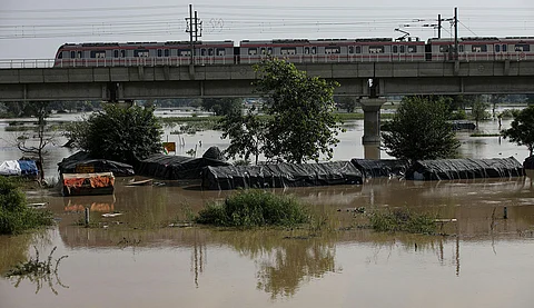

Remember the roof collapse at Terminal 1 of the Indira Gandhi International Airport due to heavy rain? There was something unusual about those torrential rains that Delhi received in the early hours of June 28, which left much of the capital city flooded. The deluge was caused by a mesoscale convective system, a thunderstorm system formed by the merging of smaller weather systems. In Delhi’s case, six weather systems converged to produce rains, according to the India Meteorological Department (IMD).
By 8:30 am, the Safdarjung observatory of IMD in southeast Delhi recorded 228.1 mm of rainfall in the previous 24 hours, marking the highest single-day rainfall in June since 1936. The Delhi ridge observatory also reported unusually high rainfall at 150.4 mm. The resultant destruction claimed 14 lives and left many injured.
The primary factor behind the convective system was the rapid and intense advance of monsoon winds from the Bay of Bengal and the Arabian Sea. This dual advance occurred on June 26 and 27, following a prolonged stalling of the monsoon troughs over central and northeastern India, according to IMD. Additional weather systems included a cyclonic circulation over northwest Madhya Pradesh and another over Haryana. These cyclonic circulations, which are anti-clockwise swirls of winds carrying moisture over land, can induce thunderstorms and rainfall. On June 27, IMD also noted the presence of a western disturbance, an upper troposphere trough, which contributed to the influx of warm, moist air into the region. An active low-pressure area over the Bay of Bengal added to the moisture. At the local level, an anticyclone over northeast Delhi at 12 km above sea level facilitated the convergence of winds in the lower atmosphere.
“Before the arrival of the monsoon, there is a lot of dry air throughout the atmosphere. The monsoon winds first fill up the lower layers of the atmosphere, which push upwards, spreading the moisture into the middle layers of the atmosphere and further upward, forming a really deep convection,” says Kieran M R Hunt, a climate scientist at the National Centre for Atmospheric Sciences, University of Reading, UK. When there is so much instability in the atmosphere, even a small disturbance can punch through its layers and explode into a huge thunderstorm. This is probably what happened in Delhi, he adds.
A RARE INTERACTION
While the influence of the western disturbance on the Delhi rainfall still needs to be studied, Hunt says the interaction of a western distur-bance and a monsoon low-pressure system was responsible for the floods in Himachal Pradesh and other regions of northwest India in July 2023. The region received heavy rains over a two-week period that claimed 105 lives and pushed many to relief camps.
Such interactions are rare because western disturbances do not usually occur during the monsoon months of June and July.
“If the subtropical jet stream (upper atmospheric bands of winds that flow from west to east) that carries western disturbances is in place over India in June and July, it is like a ticking time bomb. We then know that at some point a western disturbance is going to spin up on the jet stream, hit the monsoon and cause catastrophic precipitation, even if it is weak,” says Hunt.
The delayed retreat of the subtropical jet stream has been happening more frequently in the past 20 years or so, leading to the weather system becoming twice as common during June in the last 20 years compared to the 50 years prior to this, says Hunt.
The interaction of western disturbances and monsoon low-pressure systems is unique to India, as all the elements that come together to make a western disturbance do not exist anywhere else in the world. “The reason such interaction happens is that India sits at the bottom of a really big continent with huge swings in temperature, making the subtropical jet stream that brings western disturbances to the country during the winter and spring months move up and down. Now, as we have observed, this happens during the summer months as well,” says Hunt.
Raghu Murtugudde, professor at the Indian Institute of Technology, Bombay, says that apart from the interaction between western disturbances and monsoon winds, on must consider that even the northern Arabian Sea is very warm now and tends to spin off its own cyclonic systems. “Such cyclonic systems are responsible for the drenching of Pakistan every year since 2010. Northwest India is also experiencing increased extremes. Even pre-monsoon rain over these parts can be high now. Since these are cyclonic systems that bring rain, some are misidentified as being caused by western disturbances,” says Murtugudde.
Globally, mesoscale convective systems are responsible for most extreme rainfall events and floods, particularly in tropical regions, according to a research paper published in the journal Earth’s Future in October 2023. The paper analysed different types of rainfall-causing weather systems, such as tropical cyclones, surface cyclones, mid-level cyclones, atmospheric rivers, jet streams, frontal zones and equatorial waves. The scientists studied their tracks and influence on mean annual rainfall and extreme rainfall events from 2001 to 2020. They found that most extreme rainfall events occur because of interactions between one or more of these weather systems. But such interactions have rarely been studied. For instance, a large cluster of meso-scale convective systems was responsible for the extreme rainfall in the equatorial Indian Ocean in July 2019. A month later, an atmospheric river, along with the jet stream, triggered extreme floods in Chile. An atmospheric river is a long and narrow region of the atmosphere that carries most of the moisture outside the tropical regions.
TOO MANY VARIABLES
Forecasting mesoscale convective systems is difficult because of the lack of obvious precursors. The initial weather systems that lead to bigger thunderstorms are way too small to be captured in the grid resolutions of weather models. Once the genesis of a weather system is uncertain, it has knock-on effects on the rest of the forecasting procedure as well. Thus, the forecasts become more like educated guesses. Scientists, however, are good at predicting what these systems will do once they have formed, in terms of how they will move and where they could cause rainfall.
“So, we have to look at the general thermodynamic structure of the monsoon system for forecasting,” says Hunt. This includes the vertical structure of temperature and humidity. Another factor is the convective available potential energy, which is a measure of the fuel available for the development of a thunderstorm. “But this is a poorer way of fore-casting these events than what we have for western disturbances,” adds Hunt.
Forecasting mesoscale convective systems would require what are known as convection-permitting models, in which the smaller precursor storms that develop into larger thunderstorms are also represented. Such models are absolutely necessary in tropical areas because much of the tropical weather is driven by convection. “A model resolution of about 4-6 km is required for these models to be able to catch and forecast these thunderstorms. That would help us forecast both the mesoscale convective system and the monsoon itself,” says Hunt.
A similar challenge exists with forecasting the strength and impacts of western disturbances because of surface heterogeneity (varying structures of cities, mountains and other topographical features that influence western disturbances). “When two cars collide, we can easily trace their movements before the impact, but predicting the damage afterward is challenging because of numerous small, non-linear interactions. Similarly, when complex systems like a western disturbance and the monsoon interact with intricate topography, it becomes difficult to forecast the resulting impacts,” says Hunt.
This was first published in the 16-31 August, 2024 Print edition of Down To Earth