
Subscribe

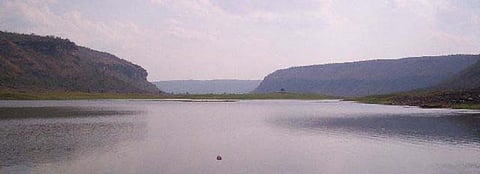
The Bihar government has begun the exercise of geo-mapping water bodies across the state — known locally as ‘jalkaro’. The water bodies that disappeared after widespread encroachment and the ones recorded as missing in official records will be included as well.
Geo-mapping will help trace and identify all water bodies to ensure proper usage, including harvesting water and conserving it.
The Bihar Remote Sensing Application Centre (BIRSAC) was tasked with handling the geo-mapping exercise.
The exercise was already underway, a senior officer in the state’s animal and fisheries resources department, told Down To Earth on April 27, 2020.
Geo-mapping will be conducted before and after the monsoon every year, the official said, adding that the government had decided to search for all the water bodies that had disappeared “in recent decades”.
Geo-mapping of water bodies was an important move and would help in identifying exactly how many water bodies there were in the state, Prem Kumar, the minister in-charge of the state’s animal and fisheries resources department, told DTE.
“Everything will be known after the completion of the geo-mapping exercise before and after the monsoon this year,” he said.
The exercise will also help the department in utilising the water bodies for commercial purposes as well, said Dharmendra Singh, special secretary of the department.
“We will be able to identify the smallest of small water bodies,” he said.
Another officer at the department said geo-mapping was the best available mechanism to identify water bodies that were either encroached upon or had been defunct from man-made activities.
“This step will give us a clear idea about encroached water bodies and the need for their renovation,” he said, adding that the exercise was a part of the state government’s Jal Jeevan Hariyali mission.
The objective of the mission is to focus on developing wetlands — locally known as chaur.
Its first phase is likely to be completed before June 15 in all of the state’s 37 districts.
There are 30,395 water bodies present in the state, according to government records.
Officials at the fisheries department, however, said this was much lower than the actual number of water bodies that existed in the state in the 1970s and 1980s.
Hundreds of big ponds disappeared in the water-rich districts of north Bihar in the recent years, according to Narayan Choudhary, convenor of Talaab Bachao Abhiyan (Save Lakes Campaign).
There were 350 ponds in Darbhanga town in 1960, according to the district gazetteer. This number dipped to 250 in the 1990s, with fewer than 100 ponds now, according to data from the Darbhanga district’s municipality.
Hundreds of ponds around urban centres across the state disappeared in the past two and a half decades, said Rajeev, a local water activist.
Ponds are an easy target for encroachment by powerful land developers who enjoy the support of politicians and bureaucrats, according to him.
“Ponds are either encroached upon forcibly and deliberately filled with waste to finish them,” he added.
Ponds played an important role in natural water harvesting during the monsoon, said Rajeev.
The ability of ponds to easily recharge groundwater and prove water security has been accepted by experts throughout the world.
