
‘India a laboratory for seismologists’

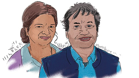
India is no stranger to earthquakes. In recent memory, Latur and Bhuj districts in Maharashtra and Gujarat witnessed devastating tremors in 2003 and 2001 respectively. Such quakes leave clues that can aid preparations for future events, say seismologists Kusala Rajendran, professor, Indian Institute of Science, and C P Rajendran, adjunct professor, National Institute of Advanced Studies. The Rumbling Earth—The Story of Indian Earthquakes, captures their work on historical as well as recent quakes. In an interview with Down To Earth, they discuss the science of earthquakes, why the Himalayas are due for a huge event and why prediction remains a challenge. Excerpts:
Your book aims to introduce your work on earthquakes for a general audience. Why did you feel this was needed?
Kusala Rajendran: Every time we have an earthquake, I have noticed that most journalists who try to report on the event struggle because they are unaware of the basic things about earthquakes. I have also seen the public interest in learning about earthquakes. When people ask me what I am working on and I say earthquakes, I usually end up giving them a mini-lecture on plate tectonics [a scientific theory explaining the movement of the earth’s upper plate, which is about 100 km thick and is broken up into separate tectonic plates].
People also ask us why earthquakes occur in some places and not others; and whether it will happen near their hometown. When we see so much curiosity, communicating is important. There is also a lot of academic interest in why earthquakes occur. Given our long experience of working on Indian earthquakes, we also had a lot of human-interest stories that we thought should be shared. India is like a laboratory for seismologists because we have the Himalayas and the Andaman and Nicobar Islands, areas with active subduction zones where tectonic plates collide and thrust beneath each other. Though rare, damaging earthquakes do occur within the plate interior, like in Latur. We also have one of the largest and most spectacular examples of reservoir-induced earthquakes in Koyna, Maharashtra. We already had the material and experiences to put the book together.
C P Rajendran: Our work in paleoseismology was also the beginning of a new line of research in India. Thus, the book also partly became a biographical sketch for the two of us.
How did you begin your work in paleoseismology?
C P Rajendran: In the early 1990s, when Kusala was pursuing her Doctor of Philosophy degree at the University of South Carolina, and I was doing my postdoctoral research, we worked on understanding quake sources and the maximum possible magnitude in the coast of South Carolina. In 1886, Charleston city in South Carolina was impacted by a quake with a nearly 7.5 magnitude, causing a lot of devastation. Savannah River Nuclear Solutions, a plant owned by the US Department of Energy, wanted to know the risk of earthquakes in the region and how they would impact the nuclear reactors.
On the field in Charleston, we found for the first time evidence of liquefaction being generated by earthquakes during strong ground-shaking. Liquefaction occurs when groundwater pressure increases, leading to a loss of strength and stiffness in the soil. This gets preserved in the sedimentary sections of soil. The 1886 Charleston earthquake generated a lot of liquefaction in that area and many historical reports were available. We could record proof for many earlier earthquakes like the 1886 event.
After five years of work there, we returned to India, where we started studying the 1993 Latur earthquake in Maharashtra. This was the first study in India to understand the evidence of past earthquakes under paleoseismology. We later moved on to Kutch in Gujarat. A big earthquake in 1819 raised the land due to a fault movement and formed a ridge called Allah Bund (mount of God). This was evidence of an earthquake, and the aim was to find remnants of land-level changes brought about by the earlier earthquakes.
How has seismological research developed in India?
C P Rajendran: In the 1960s, global seismological research advanced quite a bit because of the worldwide surge in data collection and understanding of plate tectonics. Indian seismologists were also doing well at this. But by the mid or late 1980s and 1990s, GPS (Global Positioning System), digital seismic technology and satellite technology advanced quite a lot. The Indian scientific community could not catch up with these developments, most of which had originated in the West. In the volume of literature on Himalayan earthquakes, about 80 per cent comes from foreign authors. Training programmes in seismology in India are restricted to a few Indian Institutes of Technology (IITs).
The early 1990s saw a series of devastating earthquakes, like in Latur in 1993 and in Chamoli in 1999. These events led to a surge in seismological research and funding was made available through the Department of Science and Technology, helping researchers like us and several other teams from the National Geophysical Research Institute in Hyderabad. The 1990s was the beginning of modern seismological research in India.
The book mentions possibility of a large earthquake striking the Himalayas. How did you arrive at this insight?
C P Rajendran: We have produced many insightful results on the frequency of big earthquakes in the Himalayas. By studying the plate movement and the accumulation of stress during the plate interaction, and comparing it with the production of earthquakes, we see a large gap in the central segment, starting from Himachal Pradesh to the Nepal border.
Going by the strain build-up calculation, we should have seen at least a few big earthquakes. But based on past evidence, we have not seen any such events in the past 500-600 years. From what we understand about earthquakes, the strain accumulation between plates should be compensated by the production of earthquakes. But that is not happening there. There is a gap in the strain accumulation and the productivity of earthquakes. Consider the strain build-up like adding money to your savings bank. The bank balance goes up and if you never take the money out, it keeps accumulating. When an earthquake occurs, the accumulated stress is released. When the next big earthquake occurs in the Himalayas, we expect it to exceed an 8.5 magnitude.
Kusala Rajendran: But these predictions are not easy. When a plate moves at the rate of say 5 cm per year, as is happening with the Indian Plate, it accumulates stress along the plate boundaries that must be released. This happens along every fault [fractures in Earth’s crust] that moves because of plate tectonics. In simple words, stress builds and this will weaken the rocks, causing them to slip.
But it is not as simple as a fault rupturing and releasing energy periodically. Many complexities are involved that we do not yet fully understand. For example, some faults may be buried with no expressions on the surface. We can say an earthquake will occur because the plate movements build up stresses along their margins. Still, we cannot say that an earthquake will happen at this specific place, at this time of the year, or that it will be of this magnitude. Because two earthquakes can make up for one large event, or one earthquake can trigger another one. For example, in Nepal, many scientists predicted that an earthquake in the Himalayas would move southward and affect the Indo-Gangetic plain. But that did not happen. It moved eastward, triggering another earthquake in the east, which surprised the researchers, and it created more damage because the quake was almost a similar size.
Earthquake science is still very nascent. We do not have repeated earthquakes and they happen with some time gap of several hundred years. We are sitting on data from one event from the past, like the 2015 Nepal earthquake and the 1897 Shillong earthquake. We know only what has happened during that one cycle and nothing beyond that. The processes leading to an earthquake are not in the realm of direct observation, and their complex interactions are not fully understood. Right now, we can only say at best, that earthquakes will happen in this area because of the size of the fault, nature of stress build-up and long absence of earthquakes in the region.
Can quakes in peninsular India reach a higher magnitude, too?
Kusala Rajendran: It is believed that plate tectonics cycles repeat every 200 million years and reformat. During the past cycles, Himalaya-like structures must have formed in many parts. Being in constant motion, they keep moving and colliding and then get eroded during the long periods of plate motions. That is how we expect the Himalayas to disappear in about 200 million years. But this process leaves certain imprints that geologists refer to as suture zones. We have such structures in peninsular India, like the Narmada rift, an east-west-oriented structure that cuts across the Indian subcontinent that resulted from a collision that occurred some 500 million years. Over time, these structures get broken up into smaller segments of faults and so cannot create large earthquakes.
The southern parts of the country do not have geologically young and active structures. Instead, we see relics of previous, old tectonic history. They still have some faults and respond to the same plate tectonic motion along the Himalayas. However, as they are older and broken up into smaller units, they will not be able to sustain a big earthquake. Also, stress (force) transmitted from the faraway plate boundary, the Himalayas, is dissipated, so we see something like the 1993 Latur quake, which was only of magnitude 6.3. This moderate earthquake caused substantial damage due to lack of preparedness and awareness, since the non-engineered abodes are not designed to withstand shaking.
The Andaman and Nicobar Islands are also tectonically active. Is it then safe to move forward with the Great Nicobar project to build a transhipment port, airport, and power plant on the southern tip of the island?
C P Rajendran: Great Nicobar is a place where localised damaging earthquakes can happen. One of the government’s rejoinders in connection with the Great Nicobar project noted that since the area already faced a big earthquake in 2004, the next big quake might occur only after 500 years. They probably used some of our data to make that argument. However, they do not consider that there are unbroken segments elsewhere along this plate boundary. Big earthquakes that occur during an average interval of about 500 years can break a fault through its entire length starting from Sumatra to the northern tip of Andaman Island.
The Great Nicobar region and the nearby Sumatra part of the trench can also generate local big earthquakes, with the potential to generate large tsunamis. Local quakes of magnitude 8 are not uncommon in the southern Sumatra part of this trench.
The ninth chapter of the book mentions the need to prepare for earthquakes in the Bihar-Nepal segment, which currently is in the calm phase but may become active again. Is India ready?
C P Rajendran: This requires a lot of discussion. Unlike floods or cyclones, which are amenable to short-term prediction, earthquakes come without warning. So naturally, we need to improve a lot in terms of preparedness. Tsunamis occur after great earthquakes and there is a significant time lag for distant shores, so can we predict them through ocean-borne instrumentation and modelling. To some extent, we have succeeded in this. But we have not done much, qualitatively speaking, in earthquake preparedness.
Kusala Rajendran: We have not attempted to create an inventory of vulnerable built structures. This requires a great deal of work, especially for heritage structures. We do not do this systematically and that is a problem. This approach is as fundamental as earthquake drills. India has the economic resources, knowledge and techniques to incorporate these aspects. Countries like the US and Japan have made huge advances in earthquake preparedness. We have come nowhere close. There are experts in India who can do a lot of work on this, and international collaborations could help. We should be having seminars and symposiums, talking to people, developing a standard operating procedure in case of a major disaster, and teaching people how to prepare for potential hazards. This should be part of continuing work.

EXCERPT
‘Wouldn’t it be wonderful if we could predict damaging earthquakes...’
Wouldn’t it be wonderful if we could predict damaging earthquakes and be forewarned about their time, size and location days or hours before they occur-like we predict cyclones? Every time an earthquake occurs, the scientific community is asked why it can’t predict earthquakes as they predict the weather...
We must reckon that predicting an earthquake’s exact time, size and location so that a warning can be issued is not yet a realizable goal. However, there are ways to estimate the probability of an earthquake occurring in a region over decades, which would improve earthquake preparedness and mitigate damages. Such ‘long-term forecasts’ rely on statistical models based on the earthquake history of the place and close monitoring of the current seismicity. Knowing the recurrence period or pattern of earthquakes on specific fault lines will also help in long-term forecasting. Scientists have been able to make such forecasts in some parts of the world, such as California. Satellite-based radar imaging of surface deformation prior to an earthquake is a new tool that aids in earthquake forecasting. The combined use of satellite-based measurements and modelling of crustal deformation and fault-specific geological studies have made such forecasts possible, at least in some regions.
In summary, the current state of knowledge helps to identify the most likely region of an earthquake disaster. However, obtaining an estimate of the precise timing, location and size of the likely event is beyond the present capabilities. The devastating 25 April 2015 Nepal earthquake of magnitude (M, 7.8), the most recent one in the Himalayas, is a good example to appreciate the complex issues involved in the occurrence of earthquakes, even in long-term forecasting. The Nepal segment of the Himalayas has produced large earthquakes in the past.
(Excerpted from The Rumbling Earth with permission of Penguin Random House India)
This was first published in the 16-31 January, 2025 print edition of Down To Earth