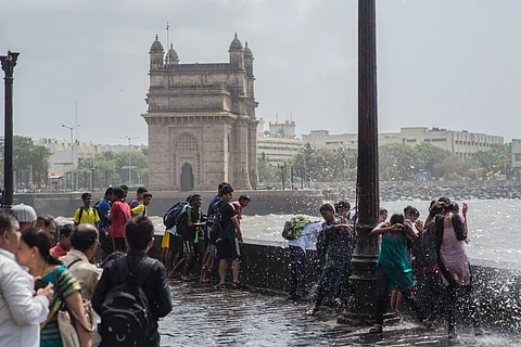

Monsoon is on a record-breaking spree this year. On May 26, it arrived in Mumbai way ahead of its anticipated arrival on June 11. According to the India Meteorological Department (IMD), this is the earliest recorded arrival of the southwest monsoon in the country’s financial capital.
With the arrival of the monsoon, the metropolis was pounded with heavy rainfall for two consecutive days, which led to breaking yet another record.
It is important to note that May 2025 has been the wettest ever May month in Mumbai, which almost came to a grinding halt due to waterlogging in several low-lying areas, including flooding of stations on Mumbai Metro Line 3 and ‘temporary’ suspension of services.
As per IMD’s rainfall data, between May 1 and May 27 this year, Mumbai City (Colaba observatory) received 456.5 millimetre (mm) of rainfall and Mumbai Suburbs (Santacruz observatory) received 342 mm rainfall. Thus, surpassing the previous record of 280 mm rainfall in the city in May month in 1918.
Daily rainfall data shows that in 24 hours between 8:30 hrs on May 25 and 8:30 hrs on May 26, Mumbai City received 135.4 mm rainfall against its normal of 0.2 mm — an excess of 67,600 per cent.
The next day, between 8:30 hrs on May 26 and 8:30 hrs on May 27, Mumbai City received 161.9 mm against a normal rainfall of 0.6 mm — an excess of 26,883 per cent. For Mumbai Suburbs, these figures stand at an excess of 16,650 per cent and 15,922 per cent rainfall on these two days, respectively.
“Monsoon setting early in Mumbai by 14 days is not very common. The city experienced heavy rainfall on two days, which is associated with the monsoon onset over the region and an associated low pressure system,” M Rajeevan Nair, a climate scientist and former secretary of the Ministry of Earth Sciences, told Down To Earth.
“Nowadays, we see a tendency of getting heavy rainfall amounts falling in very short duration. It happened in Mumbai now. This tendency is associated with global warming,” he added.
Warmer air can hold more moisture. Research shows that for each 1°C of warming, saturated air contains seven per cent more water vapour on average. The increase in atmospheric moisture content increases the risk of extreme precipitation events. Just as a bigger bucket can hold and dump more water, a warmer atmosphere can hold more water vapour and therefore dump more water when it rains.
“What is extremely strange is that the southwest monsoon normally takes 10-11 days to travel from Kerala to Mumbai. The normal onset date of the monsoon over Kerala is June 1. But this year, the onset happened on May 24 and within two days, that is by May 26, it arrived in Mumbai,” said Rajesh Kapadia, a Mumbai-based private weather forecaster, who has been running Vagaries of Weather blog for the past 17 years.
“In the past over five decades of my weather forecasting work, I have never experienced anything like this before,” Kapadia told Down To Earth. According to him, the rains in Mumbai will now take a brief pause and there will be a dry spell between May 29 and June 7 with negligible rainfall in Mumbai, Pune and interior Maharashtra.
"The progress up the coast from Kerala to Maharashtra was hastened by a low pressure system, which persisted for four days, moving from off the Maharashtra coast into interior Maharashtra. This resulted in an initial pull effect on the monsoon," Kapadia added.
According to meteorologists, a combination of factors led to the early arrival of monsoon over Mumbai and record-breaking rainfall.
“A series of westward propagating equatorial Rossby waves interacted with the developing background monsoonal circulation, which enhanced rainfall and accentuated monsoon onset,” K S Hosalikar, a climate scientist and former head of Climate Research & Services at IMD Pune, told Down To Earth.
Oceanic and atmospheric Rossby waves — also known as planetary waves — naturally occur largely due to the Earth's rotation. These waves affect the planet's weather and climate.
According to Hosalikar, strong westerly to south westerly currents prevailed over Arabian Sea, which brought required moisture to the land on the west coast, Also, there was an upper air circulation in Central Arabian Sea at about Ratnagiri latitude, and a well marked low (the remnant of depression that moved inside from Ratnagiri-Dapoli earlier last week) over around South Madhya Maharashtra and adjoining Marathwada area of the state.
“This further enhanced the westerly flow over Konkan including Mumbai resulting in heavy to very heavy rains with isolated extremely heavy rainfall in Konkan and the ghat areas,” explained Hosalikar.
He went on to add that “150+mm rainfall in Mumbai is very common, but most of it came in short morning intervals causing the disruption in the city, as it came in record earlier onset. Maybe the city authorities were not fully geared up. So the impact was felt more due to ground realities and not fully due to rains only.”
Rajeevan explained the reasons for an early arrival of southwest monsoon in the country this year. “Monsoon onset and progress is associated with the northward movement of the cloud band, which we call inter-tropical convergence zone, or ITCZ. It is nothing but an east-west zone of convergence of moist air.”
“This year, it started moving north early after an early monsoon onset over Kerala. When ITCZ moves north, the monsoon also advances northwards. The reason ITCZ started moving early this year is due to favourable atmospheric conditions over the Indo-Pacific region. So early monsoon onset by 14 days is rare but can be explained,” said Rajeevan.
According to Rajeevan, what matters even more than the total 24-hour rainfall is the intensity and timing of sub-daily rainfall because it rarely rains evenly throughout the day.
“We never looked at sub-daily rainfall in the past. In the monsoon season, it does not rain in all 122 days. Even when it rains in a day, it does not rain in all 24 hours. So, the seasonal rainfall is contributed by rains occurring in a few hours. Therefore, we need to understand the dynamics of sub-daily rainfall extremes and improve its prediction,” said Rajeevan.
In a recent first-of-its-kind research study, Sub-daily scale rainfall extremes in India and incongruity between hourly rain gauges data and CMIP6 models, co-authored by Rajeevan and two other scientists from Indian Institute of Science Education and Research (IISER) in Tirupati, Andhra Pradesh, it was found that the frequency of short-duration heavy rainfall events (HREs) over central India and long duration HREs over northern west coast of India is increased in the recent decades than in earlier decades.
“This study is the first study to address these issues based on IMD's hourly rainfall data. We need to carry out more similar studies and develop an early warning system for sub-daily rainfall variations. This is a tough task, but we should do it,” the climate scientist stressed.
“Mumbai monsoon has its own reputation and super dynamics and the city will surely see more such heavy rainfall days during the season as per its climatology,” Hosalikar summed it up.