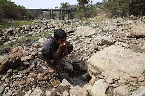

Heat wave conditions are very likely to persist in isolated pockets of west Rajasthan from May 19-24, East Rajasthan during May 19-22 and Haryana during May 19-21, according to the India Meteorological Department (IMD).
Extremely heavy rainfall is very likely in isolated places over Karnataka on May 20 and 21 and over Konkan on May 21. Very heavy rainfall is likely in parts of Tamil Nadu, Puducherry and Karaikal, Assam and Meghalaya on May 19 and 20 and in Kerala, Mahe and Madhya Maharashtra from May 19-23.
Hot and humid weather is likely to prevail over Odisha on May 19 and 20, with warm night conditions expected in isolated pockets of Haryana and Rajasthan during the same period.
In the Northeast, fairly widespread to widespread light to moderate rainfall, with thunderstorm, lightning and gusty winds (30-50 kilometres per hour), is expected during the next seven days. Isolated very heavy rainfall is likely over Assam and Meghalaya on May 19 and 20.
In Northwest India, isolated hailstorms are very likely over Himachal Pradesh on May 19 and over Uttarakhand on May 19 and 20. Dust storms (40-50 kmph) are expected in west Rajasthan from May 19-22 and over Punjab and Haryana on May 19.
Over Delhi-National Capital Region, partly cloudy skies with very light to light rain, thunderstorm, lightning and gusty winds (30-40 kmph) are forecast from May 19-22, temporarily reaching 50 kmph during storms.
In the south, fairly widespread to widespread rainfall with thunderstorms and gusty winds is expected over Kerala, Karnataka, Tamil Nadu, Andhra Pradesh, Telangana and adjoining areas over the next week.
In western India, thunderstorms with squall winds (50-60 kmph, gusting to 70 kmph) are likely over Konkan & Goa and Madhya Maharashtra during May 19-23 and over Marathawada during May 19-21.
In central and eastern India, isolated heavy to very heavy rainfall is likely over Sub-Himalayan West Bengal, Sikkim and Bihar during May 19-22 and over Jharkhand on May 19 and 20. Thunder squalls with wind speeds of 50-60 kmph gusting to 70 kmph are expected in Gangetic West Bengal on May 19 and in Chhattisgarh on May 21.
Conditions are favourable for further advance of the southwest monsoon into additional parts of the Arabian Sea, Bay of Bengal and northeastern India during the next 2-3 days, IMD added.