

Summary
Heavy rainfall threatens over 20 states, with Madhya Pradesh facing very heavy showers and heightened flash flood risks in vulnerable districts.
Uttar Pradesh and eastern Rajasthan brace for intense rainfall, sudden flooding, waterlogging and dangerous rises in rivers and local streams.
Bihar, Jharkhand, Uttarakhand, Himachal Pradesh and northeastern states expect heavy rain, thunderstorms, lightning and gusty winds through Friday.
Southern India faces thunderstorms and lightning, with winds reaching 40 to 50 kilometres per hour in several affected regions.
Palayamkottai records 40.2 degrees Celsius, while Cherrapunji receives 70 millimetres rainfall amid widespread monsoon activity across the country.
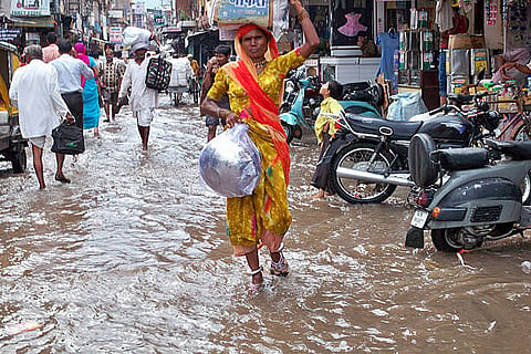
Large parts of India remained under the grip of an active monsoon on Friday, September 4, as very heavy rainfall threatened more than 20 states and raised concerns over flash floods, waterlogging, thunderstorms and strong winds.
According to the latest weather update issued by the India Meteorological Department (IMD) on Friday morning, a low-pressure area over northern Madhya Pradesh and adjoining southern Uttar Pradesh is expected to remain nearly stationary for the next two days. The system is likely to trigger widespread rain accompanied by thunderstorms and gusty winds across Madhya Pradesh and neighbouring regions.
The monsoon trough continues to remain active, extending from Bikaner and Sikar in Rajasthan through northern Madhya Pradesh and adjoining southern Uttar Pradesh, before moving towards Daltonganj in Jharkhand, Berhampore in West Bengal and onward to Tripura.
Madhya Pradesh is expected to be among the worst-affected states on Friday, with an orange alert issued for heavy to very heavy rainfall. Rainfall between 115.6 mm to 204.4 mm is possible in isolated areas.
The northern and western districts face an increased risk of waterlogging and sudden flooding, particularly in low-lying areas and near rivers and streams. Residents have been advised to remain alert and avoid unnecessary travel through vulnerable locations.
Heavy rainfall is also forecast over parts of Uttar Pradesh and eastern Rajasthan. Jhansi and Lalitpur in western Uttar Pradesh have been identified as areas where sudden flooding could occur following intense rainfall. Small rivers, streams and low-lying roads may rise rapidly.
In eastern Rajasthan, districts including Baran, Jhalawar, Bundi, Kota, Tonk, Sawai Madhopur, Dausa, Karauli, Dholpur and Bharatpur are facing the possibility of rapidly rising water levels. Authorities have urged residents to monitor weather developments and stay away from flooded roads and vulnerable crossings.
The weather department has forecast heavy rainfall over parts of Arunachal Pradesh, Assam and Meghalaya, Bihar, Haryana, Chandigarh and Delhi, Himachal Pradesh, Jammu and Kashmir, Ladakh, Nagaland, Manipur, Mizoram, Tripura, Punjab, Uttarakhand, West Bengal, Sikkim and western Uttar Pradesh.
Rainfall between 64.5 mm to 115.5 mm is possible in these areas. Bihar, Jharkhand, Rajasthan and several northeastern states may also experience thunderstorms accompanied by strong winds and lightning.
A separate trough extending from the low-pressure area across Bihar, northern Jharkhand, sub-Himalayan West Bengal and southern Assam towards Nagaland is expected to strengthen cloud development and rainfall activity. A western disturbance in the middle and upper atmosphere could also bring changing weather, thunderstorms and rain to Jammu and Kashmir, Himachal Pradesh and Uttarakhand.
Thunderstorms, lightning and gusty winds are also expected across parts of southern India. Andhra Pradesh, north interior Karnataka and Tamil Nadu-Puducherry may experience winds reaching 40 to 50 kilometres per hour during thunderstorms.
Parts of Telangana, south interior Karnataka and Rajasthan may also witness strong winds and lightning. Thunderstorms accompanied by lightning are likely in Assam and Meghalaya, Chhattisgarh, Madhya Pradesh, Vidarbha, Madhya Maharashtra and other northeastern areas.
Despite widespread rainfall, temperatures remain above normal in several parts of the country. Arunachal Pradesh recorded maximum temperatures 3.1 to 5 degrees Celsius above normal in many areas, while above-normal temperatures were also reported from parts of Assam and Meghalaya, Rayalaseema and Kerala.
On September 3, Palayamkottai in Tamil Nadu recorded the country's highest maximum temperature at 40.2 degrees Celsius. Haflong in Assam recorded the lowest minimum temperature among the plains at 17 degrees Celsius.
The previous 24 hours brought substantial rainfall to several locations. Cherrapunji in Assam and Meghalaya recorded 70 mm, while Jhansi received 60 mm. Meenambakkam in Chennai recorded 40 mm, while Puducherry, Gwalior and Sultanpur each received around 30 mm.
The weather conditions call for heightened caution from both farmers and the general public. Farmers have been advised to ensure proper drainage in fields, postpone irrigation and spraying of fertilisers or pesticides during heavy rainfall, and move harvested crops to elevated and protected locations.
Residents should remain away from trees, electricity poles and weak structures during storms. People should avoid open fields and water bodies during lightning and should never attempt to cross flooded roads, bridges or swollen streams. With several weather systems remaining active simultaneously, widespread rainfall is expected to continue across central, northern, eastern and northeastern India in the coming days.
