
Subscribe

Heatwave conditions are likely to prevail over West Rajasthan during June 8-11, the India Meteorological Department (IMD) said in its daily press release.
Hot and humid weather is expected over Coastal Andhra Pradesh and Yanam on June 5 and over Tamil Nadu, Puducherry and Karaikal on June 5 and 6.
A gradual rise in maximum temperatures by 4-6 degrees Celsius is forecast over northwest India and by 2-4°C over central India during the next 3-5 days. A similar increase is expected over eastern India from June 6.
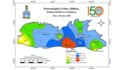
In the northeast, light to moderate rainfall is likely at most places during the next seven days, with isolated heavy showers over Arunachal Pradesh, Tripura and Mizoram on June 5; Assam and Meghalaya on June 5, 6 and 9-11. Very heavy rainfall is expected over Meghalaya on June 5.
In the east and central parts of the country, scattered light to moderate rainfall with thunderstorms, lightning and gusty winds (40-50 kilometres per hour) is likely over Madhya Pradesh during June 5-7; and over Vidarbha, Chhattisgarh, Bihar, Gangetic West Bengal, Odisha and Jharkhand on June 5. Isolated heavy rainfall is likely over Bihar on June 5.
In the northwest, light to moderate rainfall accompanied by thunderstorms, lightning and gusty winds (40-50 kmph) is expected over Himachal Pradesh and Uttarakhand; and isolated light to moderate rainfall is forecast over Jammu and Kashmir, Ladakh, Punjab, Haryana, Chandigarh, Uttar Pradesh and Rajasthan on June 5.
In the south, light to moderate rainfall is likely at many places in Kerala and Coastal Karnataka during the next seven days. Scattered rainfall accompanied by thunderstorm, lightning and gusty winds (30-40 kmph) is forecast for Coastal Andhra Pradesh, Rayalaseema and Interior Karnataka between June 5 and 7.
Meanwhile, the northern limit of the southwest monsoon continues to pass through Mumbai, Ahilyanagar, Adilabad, Bhawanipatna, Puri, Sandhead Island and Balurghat.
For daily heat tracker, click here
