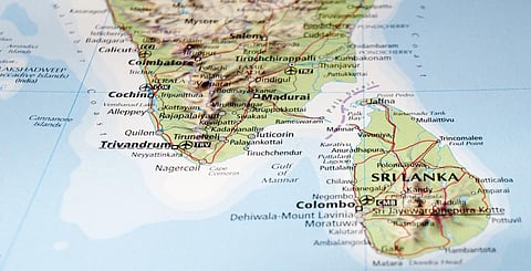

Many parts of southern Tamil Nadu got flooded on December 17-18, after the Chennai floods due to Cyclone Michaung in early December. The cause for this is an active Northeast monsoon (NEM) fuelled by the El Nino phenomenon, which is peaking right now, experts have told Down To Earth (DTE).
The El Nino is the warmer-than-normal phase of the El Nino Southern Oscillation Phenomenon (ENSO) in the central and eastern Pacific Ocean and generally enhances rainfall extremes during the NEM.
Five districts of Tamil Nadu received more than 100 mm of rainfall on December 18. The highest among these was 363.6 mm in Tirunelveli, which is 5,094 per cent more than the normal rainfall for the day. The second-highest was 343.6 mm in Thoothukudi, 7,059 per cent more than the normal. The torrential rainfall flooded both cities, and the Tamil Nadu government declared them “flood-affected” on December 19.
The other districts that have received extreme rainfall are Tenkasi (206.8 mm), Virudhunagar (149.5 mm), and Kanniyakumari (121.2 mm).
“The NEM seems to be on steroids due to the El Nino, in general, and low-pressure systems or cyclonic circulations around the region are providing the required moisture convergence for rainfall events,” Akshay Deoras, a research scientist at the National Centre for Atmospheric Science and Department of Meteorology, University of Reading, United Kingdom, told DTE.
Cyclonic circulations are whirls of winds in the upper layers of the atmosphere. They usually induce low pressure areas in the atmosphere’s lower layers, which eventually cause rainfall. Sometimes, the cyclonic circulations can cause rainfall all by themselves by bringing in moisture-laden winds into the region.
“There was a cyclonic circulation near Kanniyakumari. This led to strong upper level divergence, which creates a significant low level convergence. As a result, lots of moisture was advected by easterly winds towards south Tamil Nadu. This led to extreme rain,” Vineet Kumar Singh, a research scientist at the Typhoon Research Centre of Jeju National University in South Korea, told DTE.
Upper level divergence is the spreading out of air in the upper layers of the atmosphere, which causes air from below to rise. This leads to other winds taking their place. This process is known as ‘low level convergence’.
“After the cyclone floods, a broad and diffuse cyclonic system is near the south Tamil Nadu coast. It is pulling the northeast winds further down and creating a convergence of winds and waves over that corner of India,” Raghu Murtugudde, professor at Indian Institute of Technology, Bombay and emeritus professor at University of Maryland, told DTE.
“The waves are coming from the cyclonic system that poured boatloads of moisture into the little gap between Sri Lanka and Tamil Nadu (Palk Bay & Gulf of Mannar). A wind tunnel effect happened, I think,” he added.
Such extremes around the south Tamil Nadu and Sri Lankan coasts have been observed before as well. A research paper published in the journal Geophysical Research Letters shows that extreme rainfall in that region during the Northeast monsoon (December-February) is much more common than in the Southwest monsoon season (June-September).
The study looked at 30 different weather patterns to understand the climate variability over the Indian subcontinent and found that some of these that occurred in autumn and winter were associated with extreme rainfall around Sri Lanka and south Tamil Nadu.
Deoras, one of the authors of the study, says that one particular pattern fits the current deluge over Thoothukudi and Tirunelveli. “The pattern is predominantly present during the NEM season. When this pattern is active, the NEM strengthens, which can enhance rainfall over Sri Lanka and coastal Tamil Nadu,” he explained on X (formerly Twitter).