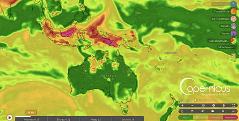


Widespread wildfires in Indonesia have triggered protests in Jakarta and other cities over the government's response to toxic haze and allegations of corruption.
Cumulative satellite hotspot detections reached 1.16 million by 21 October 2026, while satellite estimates suggest more than 1.9 million hectares had burned by the end of September.
Severe drought and an exceptionally strong El Niño have intensified the fires, with Kalimantan among the worst-affected regions.
Smoke has spread across Southeast Asia, prompting school closures in Malaysia and Timor-Leste and prolonged unhealthy air quality in Singapore.
Indonesia has deployed 47 aircraft and 60,000 personnel to fight the fires, while Malaysia has offered additional assistance.
Toxic air pollution from widespread wildfires in Indonesia has triggered protests in several cities and prompted emergency measures in neighbouring countries. Land-use changes and poorly managed fires linked to commercial activities remain major drivers of the regional public health emergency, while the ongoing strong El Niño event in the equatorial Pacific Ocean has exacerbated conditions for the still raging fires.
Protests over what demonstrators described as inadequate government action and alleged corruption linked to the fires and toxic haze erupted in the capital, Jakarta, on October 20, with young people among those taking part. Demonstrations were also held in Bandung and Yogyakarta on Java island, Pekanbaru on Sumatra and Makassar in South Sulawesi, according to news agency AFP.
The cumulative number of wildfire hotspot detections rose from 1.06 million on October 14 to 1.16 million on October 21, according to Nusantara Atlas, an independent monitoring platform developed by The TreeMap, a social enterprise registered in France.
The total area burned also increased from nearly 896,000 hectares at the end of August to more than 1.9 million hectares at the end of September, according to Nusantara Atlas data based on Sentinel-2 satellite imagery.
However, the actual area affected could be higher because satellite observations can be obscured by haze, Nusantara Atlas founder David Gaveau told AFP.
Ristianto Pribadi, a spokesperson for Indonesia's foreign ministry, told AFP that the government was still calculating the total area burned and that the Nusantara Atlas figures “cannot be readily confirmed”.
The estimated area burned between January and September was 38 per cent higher than during the same period in 2019, previously the worst fire year in its monitoring record, according to a blog published on Nusantara Atlas.
“By October 18, cumulative satellite hotspot detections were also 67 per cent higher than during the same period in 2019. This comparison uses the same satellites in both years, avoiding an artificial increase caused by adding sensors," the authors wrote.
Swamp vegetation accounted for 35 per cent of the burned area, followed by agricultural land and savanna and grassland at 20 per cent each, and natural forest at 4.5 per cent. Some of the burned swampland overlapped with peatland areas. Much of the natural forest affected by fires in September was in Ketapang regency and Gunung Palung National Park in West Kalimantan.
Satellite imagery showed fires burning well inside the national park's forest, something rarely seen under natural conditions, according to Douglas Sheil, a professor at Wageningen University, who spoke to Nusantara Atlas.
Kalimantan was the worst-affected region, with 684,000 hectares burned, accounting for 36 per cent of the national total, according to the monitoring platform.
September and October fall within Indonesia's usual fire season, but the fires have been particularly severe this year amid low rainfall and drought conditions since June.
Some fires may have started on plantations and agricultural land during clearing for cultivation before spreading to surrounding vegetation.
The drier-than-normal conditions have been intensified by an exceptionally strong El Niño event in the equatorial Pacific Ocean. El Niño is the warmer-than-normal phase of the El Niño-Southern Oscillation (ENSO), a natural climate pattern that generally suppresses rainfall across Indonesia and parts of the surrounding region.
Smoke from the fires has created a thick orange haze across several parts of Indonesia, with pollution spreading to neighbouring Singapore, Malaysia and Timor-Leste, and reaching as far as the Philippines. Deteriorating air quality has prompted school closures in Malaysia and Timor-Leste, according to AFP.
Singapore recorded its longest consecutive period of unhealthy air quality since 2015, when a similar haze crisis affected the country, according to its National Environment Agency (NEA). The agency classifies air quality as unhealthy when the Pollutant Standards Index (PSI) exceeds 100.
As of October 19, 2026, the NEA had sent notices to 10 companies in Indonesia, urging them to take action over the fires, according to AFP. In Indonesia, five firefighters died while battling fires in Bromo Tengger Semeru National Park in East Java, the agency reported.
Malaysia has offered to assist Indonesia with three aircraft and 52 ground personnel, according to Indonesia’s Coordinating Minister for Political and Security Affairs, Dudung Abdurachman. Indonesia has deployed 47 aircraft and 60,000 personnel to tackle the fires.