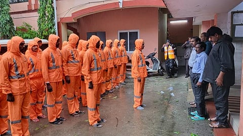

Cyclonic Storm Michaung formed over the Bay of Bengal has intensified into a Severe Cyclonic Storm, according to the India Meteorological Department (IMD).
It is likely to cross the South Andhra Pradesh coast between Nellore and Machilipatnam as a Severe Cyclonic Storm on the forenoon of December 5, 2023. Its maximum sustained wind speed is expected to range between 90 and 100 kilometres per hour (kmph) gusting to 110 kmph.
Michaung is moving slowly due to weak background atmospheric winds which steer the cyclone forward. As a result, it is moving slowly, causing heavy rainfall in the capital of Tamil Nadu, Vineet Kumar Singh, a researcher from Typhoon Research Centre, Jeju National University, South Korea, told Down To Earth. “The rainbands are hovering over Chennai for a longer duration,” he added.
In the last 24 hours, he wrote on X, Chennai received 230 millimetres (mm) of rainfall and is expected to see the worst flooding after December 2015. The expert highlighted that another 200 mm is possible till 3-4 pm on December 4.
According to IMD, as of December 4, Chennai’s Meenambakam and Nungambakkam recorded 250.1 mm and 230.2 mm of rainfall, respectively.
The system is about 90 km east-northeast of Chennai, 170 km southeast of Nellore, 200 km northeast of Puducherry, 300 km south-southeast of Bapatla and 320 km south of Machilipatnam, reads IMD’s latest bulletin.
During landfall on December 5, a storm surge of about 1-1.5 metres above astronomical tide may inundate south coastal Andhra Pradesh districts.
Michaung is likely to weaken to a cyclonic storm on December 5 at 5.30 pm, turning into a depression the following day.
IMD warned that North coastal Tamil Nadu and Puducherry are expected to see light to moderate rainfall in most places. Further, isolated extremely heavy falls are very likely on December 4 and isolated heavy rainfall on December 5.
Coastal Andhra Pradesh will see light to moderate rainfall at most places and heavy to very heavy rainfall at a few places on December 4 and 5.
IMD has forecast light to moderate rainfall in many places, with isolated heavy to extremely heavy falls on December 4 and isolated heavy rainfall on December 5 in Rayalaseema. Telangana and Odisha are also expected to witness showers.
Also, the cyclone is expected to wreak damage in Nellore, Tirupati Prakasam, Bapatla, Guntur, Krishna and West Godavari along with adjoining coastal districts of North Tamil Nadu-Puducherry.
Michaung is the third cyclone this season that formed over the Bay of Bengal, Singh highlights on Twitter. He added that this year has seen the highest number of cyclones after 2019.
Since 2018, a cyclone in the Bay of Bengal has formed in all three months of the post-monsoon season (October, November, and December).