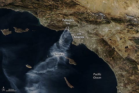
Powerful Santa Ana winds and dry conditions have fueled several destructive fires in the Los Angeles area, including the Palisades and Eaton fires, which broke out on January 7.
Satellite imagery released by National Aeronautics and Space Administration (NASA) show that the fires, which have been burning for nearly a week, continued to produce large plumes of smoke visible from space.
The Palisades fire, which ignited near Pacific Palisades, had spread across 20,400 acres (83 square kilometres) by the time the image was taken, with firefighters managing to contain just eight per cent of the blaze.
To the east, the Eaton fire, located near Altadena, had scorched 13,700 acres (55 square kilometers), with just three per cent containment.