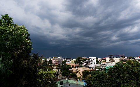

The Southwest Monsoon (SWM) season came to an official end for the India Meteorological Department (IMD) on September 30, 2025, even as the country could receive above normal rains and experience higher than normal night time temperatures in October. The monsoon winds have not yet withdrawn from the subcontinent as low pressure systems forming in the Bay of Bengal continue to bring rainfall to eastern, central and western states of the country.
The SWM seasonal rainfall for India has been above normal between June 1 and September 30, according to the IMD. The absolute rainfall during the season was 937.2 mm which is 108 per cent of the long period average (LPA). The LPA of rainfall for India between 1971 and 2020 is 868.6 mm.
The northwest region received the highest excess rainfall of 27.3 per cent and central region received 15.1 per cent more rainfall than the normal for the season. Seasonal rainfall over northwest India was the highest since 2001 and sixth highest since 1901, according to the IMD. The region also suffered from debilitating flash floods, landslides and riverine floods at the end of August and the beginning of September due to continuous heavy to extremely heavy rains in those weeks.
In stark contrast, east and northeast India received 20.3 per cent deficient rainfall. This was second lowest monsoon rainfall over the region since 1901. The meteorological subdivisions of Arunachal Pradesh and Assam and Meghalaya were two out of three subdivisions with deficient rainfall throughout the SWM season. The other one was Bihar.
The usually rain-rich Meghalaya retained its spot as the driest state in the country with an overall deficit of 43 per cent between June 1 and September 30. Arunachal Pradesh, with a forest cover of around 80 per cent, was the second driest state, having received 41 per cent less rainfall than normal for the period. On the other hand, arid and semi-arid Rajasthan remained the state with the highest excess rainfall of 64 per cent and the cold desert Union Territory of Ladakh received the highest overall seasonal excess of 342 per cent.
In the month of September, India continued to be affected by low pressure areas formed in the Bay of Bengal that moved over eastern, central and western regions of the country, causing rainfall. There were four such systems during the month. One of these intensified into a depression and one into a deep depression.
The total number of low pressure system (LPS) days in September was 23 against a normal of 12. The other reason for the ample rainfall during September were cooler-than-normal El Niño Southern Oscillation (ENSO) conditions in the equatorial Pacific Ocean which was similar to a La Niña and good for rainfall over the country, according to the IMD. Another reason for the rains was the Madden Julien Oscillation phenomenon in the Indian Ocean being in phases 2 and 3, which promotes rainfall over the country.
Throughout the SWM season, there were 69 LPS days compared to a normal of 55. IMD also highlighted some of the unique weather events that occurred during the monsoon this year. One of these was the rare cloud burst events over Chennai on August 30. Then, there were the extreme rainfall events over Telangana from September 11 to 15, over Uttarakhand and Himachal Pradesh between September 13 and 18 and the almost cloud burst type rainfall over Kolkata on the intervening night of September 22 and 23.
The monsoon started withdrawing from the western parts of Rajasthan on September 14, three days earlier than normal and by October 1, the SWM winds had withdrawn from most parts of northwest India. The withdrawal of the monsoon is on hold right now because of the low pressure activity from the Bay of Bengal causing rainfall. The normal date for the complete withdrawal of SWM from India is October 15.
This is one of the reasons the IMD has given for the excess rainfall during October. As per the weather agency, country wide rainfall could be 115 per cent of the LPA for October. The LPA for the period 1971 to 2020 is 75.4 mm. The IMD predicted that there could be above normal rains for most parts of the country except for some parts in northwest, isolated pockets in southern and northeast regions of the country. In these regions, the rainfall could be normal to below normal.
IMD forecasts a good North East Monsoon (NEM) rainfall season which begins from around mid-October and brings rains to most parts of south Peninsular India. The weather department says that NEM rainfall could be 112 per cent of LPA for the five meteorological sub divisions of Tamil Nadu, coastal Andhra Pradesh, Rayalaseema, Kerala and south interior Karnataka. The LPA for 1971 to 2020 is 334.13 mm. The rainfall during the period could be enhanced by the commencement of La Niña conditions in the equatorial Pacific Ocean for which IMD says there is a 71 per cent chance between October and December.
Another weather aberration to look out for would be increasing temperatures during October. While maximum temperatures could remain above normal for many parts of extreme northwest India and northeast India, the minimum temperatures could be above normal for almost the entire country.