
India’s total forest and tree cover collectively is estimated to be 25.17 per cent, with an increase of 156.41 square kilometres (sq km) compared to the previous estimate, according to the State of Forest Report 2023.
India has a forest cover of 7,15,342.61 sq km (21.76 per cent) whereas the tree cover is 1,12,014.34 sq km (3.41 per cent), according to the biennial report published by the Union Ministry of Environment Forest and Climate Change (MoEF&CC) on December 21. The last assessment was released in 2021.
The environment ministry defines “forest cover” as “all lands, more than or equal to one hectare in area, with a tree canopy of more than or equal to 10 per cent, regardless of its ownership, legal status and includes orchards, bamboo and palm”.
The “tree cover” is known as “the area covered by trees outside recorded forest areas”.
But the state-wise data from the report shows severe decline across the country. For instance, the forest cover inside Assam’s Recorded Forest Area (RFA) — which are forests as per government records — has reduced by 86.66 sq km.
The Moderately Dense Forest (MDF) of 8,333 sq km has reduced to 4,468 sq km, while Very Dense Forest has seen an increase from 2,789 sq km to 2,833 sq km.
In Tripura, the forest cover inside the RFA has shrunk to 116 sq km.
Similar decline has been seen in Arunachal Pradesh, Assam, Gujarat, Telangana and Ladakh.
By RFA, the report refers to “any area recorded in forest government records under the category of Reserved Forests, Protected Forests”.
The areas outside recorded forests are identified as “tree stands with canopy densities that exceed 10 per cent and sizes of one hectare or more”.
The report explained, “Most of the RFA is indeed covered with vegetation. However, within these RFAs, there may be some areas with less than 10 per cent canopy density. Such areas are excluded from the definition of forest cover. They are included in the forest cover assessment in the report.”
Additionally, there can be tree stands beyond the RFAs, with canopy densities exceeding or equal to 10 per cent and sizes of 1 ha or more. These areas are also considered as part of the forest cover assessment by the Forest Survey of India, the report said.
A total area of 46,707 sq km in terms of canopy density has degraded from very dense forest, moderate dense forest, open forest to non-forest inside the RFA.
The highest degradation, seen in the range of 0-10 hectares, was recorded in an area of 31,709 sq km, followed by 10-50 hectares with an area of 9,531 sq km. The report observed that the area recording canopy degradation of more than 50 hectares was 5,466 sq km.
In terms of canopy degradation of more than 50 hectares, Mizoram saw the highest degradation at 892.81 sq km, followed by Rajasthan at 558 sq km and Telangana at 557 sq km.
The report has also highlighted an area of 92,989 sq km available for degradation from under various categories. It also recorded an area of 44,891 sq km available to be degraded from MDF, open forest and scrubs to non-forest.
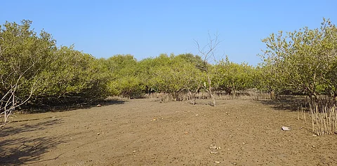
In terms of mangrove forests, Gujarat saw the highest loss in its cover. In 2023, the state reported a 36.39 sq km reduction in its cover, compared to the 2021 assessment. The highest cover lost was 61.14 sq km in Kutch.
The Andaman and Nicobar Islands also recorded a loss of 4.65 sq km of mangrove forests, compared to the previous assessment.
Maharashtra and Andhra Pradesh showed the highest increase in its mangrove cover among 12 states at 13.01 sq km and 12.39 sq km.
Prakriti Srivastava, retired principal chief conservator of forests (PCCF), Kerala said the report still does not answer any points raised by State Expert Committee (SEC) reports and the Lafarge order as directed in the TN Godavarman judgement.
She termed it as a violation of Supreme Court orders. “It means the government is trying to divert the forest areas that should have been identified as per SEC reports and Lafarge order,” said Srivastava.