
Subscribe

The Centre has released the Viksit Gram Panchayat Plan framework for implementing VB-GRAMG, the new rural jobs and livelihoods mission.
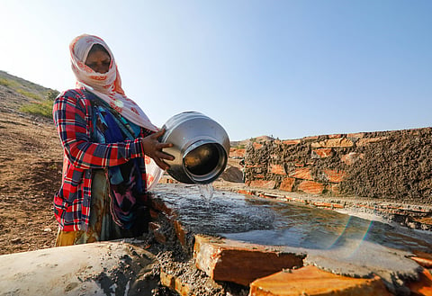
The framework prioritises water security, rural infrastructure, livelihood assets, disaster mitigation and climate resilience.
Over-exploited groundwater blocks must spend at least 65% of plan expenditure on water-related works, with lower thresholds for semi-critical and safe blocks.
Gram panchayat plans will use geospatial data from PM Gati Shakti, India-WRIS and Bhuvan, and must be approved by the Gram Sabha before being uploaded to Yuktdhara.
The Union government has released a new gram panchayat-level planning framework for implementing the Viksit Bharat – Guarantee for Rozgar and Ajeevika Mission, Gramin (VB-GRAMG).
The framework, called the Viksit Gram Panchayat Plan, will guide how rural works are planned under the new law that replaced the Mahatma Gandhi National Rural Employment Guarantee Act in December 2025. The new Act, which promises 125 days of work to the rural population, is scheduled to come into effect from July 1, 2026.
The framework places water security, rural infrastructure, livelihood-related assets, disaster mitigation and climate resilience at the centre of village-level planning. The government says the plan marks a shift from traditional “wish-list” planning to a scientific, geospatially enabled model integrated with PM Gati Shakti and Digital Public Infrastructure.
The plan will use the Yuktdhara Planning Portal, which brings together geospatial datasets from PM Gati Shakti, India-WRIS and Bhuvan. Local planners will use geotagged data, water budgeting and other scientific tools to assess existing assets and service delivery gaps.
The findings from this geospatial analysis will then be discussed through participatory planning at hamlet and ward levels before being placed before the Gram Sabha for approval.
Water security has been identified as the main planning priority, with spending thresholds based on groundwater stress.
In over-exploited blocks, at least 65 per cent of total expenditure under the plan must be directed towards water-related works. In semi-critical blocks, the minimum threshold will be 40 per cent, while areas categorised as safe blocks must spend at least 30 per cent of total expenditure on water security.
The framework treats water security as the foundation of sustainable rural livelihoods. It is expected to guide works linked to water conservation, recharge, harvesting and related infrastructure.
The document says planning should move from an activity-based approach to an outcome-based one. Success, it says, should be measured not only by the number of assets created, but by long-term impacts such as increased water availability and stronger livelihood resilience.
The framework also includes rural infrastructure such as education, health, connectivity and waste management.
Livelihood-related infrastructure will include individual and community assets, with the document saying priority should be given to Scheduled Castes, Scheduled Tribes, women-headed households and persons with disabilities. The framework also brings connectivity-related works, including state highways, expressways and national highways, within the broader planning architecture linked to PM Gati Shakti.
A separate focus area deals with disaster mitigation and climate resilience. It includes works intended to reduce vulnerability to droughts, floods and heatwaves, such as rooftop rainwater harvesting, disaster-resilient structures and afforestation for forest management.
The document says plans must maintain a balance between labour-intensive and material-intensive works, generally following a 60:40 ratio at the district level.
Under the process laid out by the Centre, each draft gram panchayat plan must be presented to the Gram Sabha for feedback and approved through a formal resolution.
Once approved, the plans will be uploaded to the Yuktdhara portal and consolidated into block, district and state plans. These will eventually form the Viksit Bharat National Rural Infrastructure Stack, or VB-NRIS, a national digital database of rural infrastructure planning and assets.
