
The Union Ministry of External Affairs (MEA) has denied that the current floods in eastern Bangladesh are due to the opening of a dam in Tripura, which is witnessing its worst floods in two decades according to reports.
Instead, the MEA attributed the reason to the Gumti, a trans-boundary river that flows from Tripura into Bangladesh. There has been heavy rainfall in the catchment of the river, which is responsible for the floods.
“We would like to point out that the catchment areas of Gumti river that flows through India and Bangladesh have witnessed heaviest rains of this year over the last few days. The flood in Bangladesh is primarily due to waters from these large catchments downstream of the (Dumbur) dam,” the MEA said in a statement on August 22, 2024.
The MEA further added that the Dumbur dam is, in fact, located quite far from the Indo-Bangla border — over 120 kilometres upstream of Bangladesh.
The dam is 30 metres in height and generates power that feeds into a grid. India’s neighbour also draws 40 megawatt (MW) power from the grid, according to the statement.
There are three water-level observation sites along the course of the Gumti as it flows through Tripura. These are located at Amarpur, Sonamura and Sonamura 2.
The Gumti flows into Bangladesh’s Chittagong or Chattogram division, where it flows through the key city of Comilla, before emptying into the Meghna, one of three key rivers of Bangladesh along with the Ganga (known as Padma in Bangladesh) and Brahmaputra (known as Jamuna).
The MEA statement cited the readings at Amarpur station, which showed how the water level arose on August 21.
“Heavy rainfall has been continuing since 21 August in the whole of Tripura and adjoining districts of Bangladesh. In the event of heavy inflow, automatic releases have been observed. Data showing rising trend has been supplied to Bangladesh upto 1500 hrs on 21 August 2024. At 1800 hrs, due to flooding, there was power outage leading to problems of communication. Still, we have tried to maintain communication through other means created for urgent transmission of data,” the ministry said.
It added that since both New Delhi and Dhaka shared 54 common cross-border rivers, floods were a shared problem inflicting sufferings to people on both sides, and required close mutual cooperation towards resolving them.
“We remain committed to resolving issues and mutual concerns in water resources and river water management through bilateral consultations and technical discussions,” the statement added.
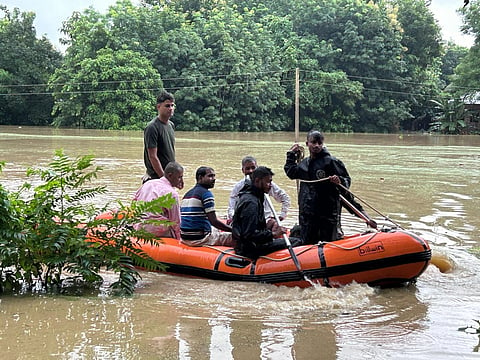
The floods led to the loss of nine lives, while over 30,000 people have been displaced, EastMojo reported on August 21.
A team from the National Disaster Relief Force arrived in Agartala on August 22, bring relief materials which will be distributed in affected areas.
Meanwhile, the India Meteorological Department (IMD), in its statement dated 1400 hrs IST on August 22, warned that a low pressure area over north Bangladesh was likely to cause very heavy to extremely heavy rainfall over Assam & Meghalaya and Tripura during the next two days.
Bagafa in the South Tripura district recorded the highest rainfall — 49 centimetres (cm) — between 8.30 am August 21 and 8.30 am August 22.
Other locations included Kvk South (South Tripura district) with 31 cm of rainfall and Agartala Aero (West Tripura district) 23 cm.
“The low pressure area over north Bangladesh persisted over the same region. It is likely to move nearly westwards across West Bengal during next 48 hours…A cyclonic circulation likely to form over North Bay of Bengal & neighbourhood around 24th August,” the IMD statement noted.