
Subscribe

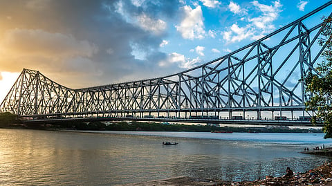
The Ganga river basin is highly water stressed and India must act as the basin houses 45 per cent of the country’s population, accounts for 44 per cent of its Gross Domestic Product (GDP) and 25 per cent of its coal fleet, a new report has warned.
The Ganga is one of Asia’s 10 major rivers profiled in the report. The assessment showed that 1.96bn people, $10.3trn worth of GDP as well as 865GW of power assets across these rivers are at risk from escalating climate risks and deepening water stress.
The world’s largest and most populous continent thus faces a ‘triple threat’ to its future — insufficient water for development, the impact of climate change on water resources, and the concentrated risks in river basins. This situation puts hundreds of millions of lives and trillions of dollars in economic growth at risk.
The report, titled No Water, No Growth 2 – Rising mother river risks threaten half the total GDP of 16 Asian countries, was released by CWR, a global thought leader in unpacking and valuing complex climate and water risks and China’s national research Institute of Geographic Sciences & Natural Resources, a part of the Chinese Academy of Sciences (IGSNRR-CAS).
In Asia, the Hindu Kush Himalayas (HKH) is the source region for 10 major rivers — Amu Darya, Brahmaputra, Ganga, Indus, Irrawaddy, Mekong, Salween, Tarim, Yangtze and Yellow.
These rivers provide water to 16 countries — Afghanistan, Bangladesh, Bhutan, Cambodia, China, India, Kyrgyzstan, Laos, Myanmar, Nepal, Pakistan Tajikistan, Thailand, Turkmenistan, Uzbekistan and Vietnam.
The 10 HKH rivers play key roles in ensuring water, socio-economic and energy security.
Water is essential for economic development. Beyond quenching thirst, water is also used to grow food, generate power, mine resources, make clothes, electronics and other consumables. So multiple sectors, trade and employment will be affected if increasingly precious water resources are mismanaged.
For countries with limited water resources, balancing trade-offs between economic development, water resource availability and quality is thus key.
The 10 HKH rivers are critical sources accounting for on average 57 per cent of the total internal surface water of the 16 HKH countries.
Over 60 per cent to 77 per cent of the Tarim, Ganga, Yellow, and Indus basin areas face high or extremely high-water stress and are arid.
‘Water stress’ is typically defined as when the rate of water usage vs. resource ratio is above 40 per cent.
According to the report, as these 16 countries are still developing, rising urbanisation will only drive more people to the cities along these rivers, adding ever more stress and pressure on river basins. At the same time, mega-cities or country capitals at the river deltas from Tianjin, Shanghai, Kolkata, Karachi to Ho Chi Minh will also face submersion from fast rising seas.
The Ganga saw the biggest population growth in absolute numbers of around 97mn people, far exceeding 63mn who flocked to the Indus and the 7.3mn to the Amu Darya. The Brahmaputra also saw a sizeable increase in population of 22mn as did the Yellow of 4.2mn.
When it comes to managing GDP growth in the HKH River Basins, per capita river resources matter. GDP growth varies across rivers. The GDP in the Yangtze grew by a stunning US$4.6trn. The Ganges, Yellow and Brahmaputra also saw significant growth ranging from 86-91 per cent. The Ganges saw an additional US$676bn of GDP generated there compared to US$620bn for the Yellow and US$153bn for the Brahmaputra.
In contrast, the Indus saw minimal growth at just 2.7 per cent (US$10bn) since CWR’s last such publication in 2018. This was lower than the Amu Darya, which enjoyed GDP expansion of 53 per cent (US$19bn). The lower growth in the Indus could be due to recovery setbacks from devastating 2022 Indus floods which inundated more than a third of Pakistan’s districts. The Mekong, Tarim, Irrawaddy and Salween saw GDP declines. Shrinkages in the economy in the Irrawaddy and Salween are likely due to the ongoing civil war in Myanmar.
All these are at risk and exposed to rising water scarcity due to accelerated glacial melt, reduced snowfall and changing monsoon patterns — all key components of river flow.
According to the report, to ensure continued development, Asia must tackle the triple threat.
In an era of rising water risks and uncertainty around water availability, policy decisions should wed economic planning to water resources and pollution management, says the report.
The authors of the report have named this concept ‘waternomics’.
A waternomic roadmap is not a nice-to-have, but an economic imperative – because without water, there is no growth.
The report’s analyses of river waternomics show that the best performing rivers are the Yellow & Yangtze. This reflects China’s waternomic efforts through national development policies for the Yangtze River and Yellow River Economic Belts.
The Ganges is even more stressed than the Indus and Yellow.
This updated report, building on CWR’s 2018 publication No Water, No Growth – Does Asia have enough water to develop? or NWNG1, calls for urgent action to curate source-to-sea waternomic roadmaps for each river to ensure economic and financial resilience as well as water, energy & food security in this unprecedented era of rising climate & water risks.
