
Water
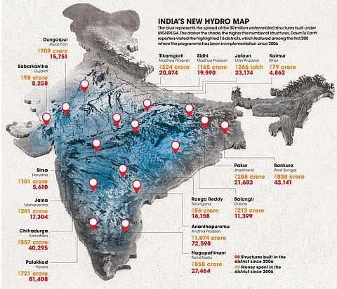
India’s new hydro map
The blue represents the spread of the 30 million water-related structures built under MGNREGA. The darker the shade, the higher the number of structures. Down To Earth reporters visited the highlighted 16 districts, which featured among the first 200 where the programme has been in implementation since 2006.


This was first published in Down To Earth’s print edition (dated 16-31 March 2021)