
Subscribe


Nearly 50 per cent of the Aravallis’ area would become vulnerable to mining if the new definition accepted by the Supreme Court is applied, a Down To Earth (DTE) analysis has found.
This contradicts the environment minister’s claim on December 23. Bhupender Yadav stated that according to the apex court ruling, 90 per cent of the Aravalli area comes under the protected zone, and there are no relaxations in this regard.
The apex court accepted the new definition on November 20, after it had directed the central government to formulate a ‘uniform’ definition within two months.
The Supreme Court, during its hearing on August 12, 2025, said: “We are only interested in protecting the precious Aravali Hills and Ranges. We do not want further damage to be caused to the entire Aravali Hills and Ranges, which act as a protector against the disturbances which come from the Northern/North-Western side of the country. If, like at present, uncontrolled mining activities are permitted, it will cause a great threat to the ecology of the nation.”
The central government then roped in the state governments of Gujarat, Rajasthan, Haryana and Delhi to understand their definition of the Aravallis in the context of mining, only to come up with a refurbished definition primarily followed by the Rajasthan government.
The new definition states: “Any landform located in the Aravalli districts, having an elevation of 100 metres or more from the local relief, shall be termed as Aravalli Hills. For this purpose, the local relief shall be determined with reference to the lowest contour line encircling the landform. The entire landform lying within the area enclosed by such lowest contour, whether actual or extended notionally, together with the Hill, its supporting slopes and associated landforms irrespective of their gradient, shall be deemed to constitute part of the Aravalli Hills.”

Using Shuttle Radar Topography Mission (SRTM), DTE applied the definition over a total area of 31,414 sq km to analyse the Aravalli hills and ranges.
According to the government definition, it found that about 49 per cent (15, 589 sq km) of area would be exposed once the definition is applied and 15,825 sq km area would remain under protection.
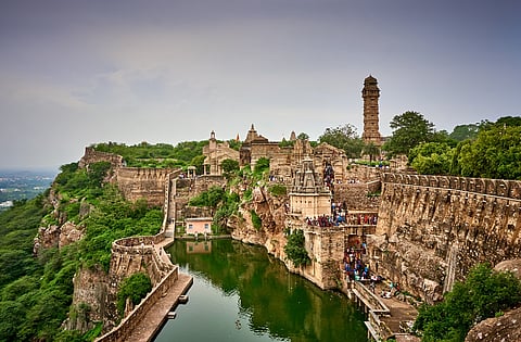
The major chunk of the land area under threat would be in Rajasthan, including the hill station of Mount Abu. It is likely that some areas near Chittorgarh fort would also be exposed.
The final report of the committee tasked by the Supreme Court with defining the Aravalli hills, titled Uniform definition of Aravalli Hills and Ranges, explicitly mentions that mining near sites such as Chittorgarh Fort requires a no objection certificate from the Archaeological Survey of India.
The fear of mining leading to potential degradation of the Aravallis holds true because the Supreme Court directed the committee to take a policy decision on the definition in the context of mining with the concern pertained to unregulated mining in the Aravalli Hills and Ranges.
According to the report, the Aravalli-Delhi system has been identified as having significant potential for critical minerals such as tin, graphite, molybdenum, niobium, nickel, lithium, and rare earth elements (REEs), all of which are of growing strategic relevance for energy transition, high-technology manufacturing, and national security.