
Subscribe

The Union Ministry of Environment, Forest and Climate Change (MoEFCC) has sought to allay concerns over the Supreme Court-backed uniform definition of the Aravalli hills, insisting that the move will not open the ecologically fragile range to fresh mining or construction and is limited strictly to regulating illegal extraction.
Addressing a press conference, environment minister Bhupender Yadav and senior officials said no new mining leases will be issued anywhere in the Aravallis, including areas outside the National Capital Region (NCR), until a scientific management plan is prepared and approved. The existing mining ban in the NCR, Yadav said, remains unchanged. Five districts in Delhi fall within the Aravalli region.
“Only 0.19 per cent of the Aravalli landscape—about 277 sq km out of nearly 1.43 lakh sq km— is currently under legal mining permits, and even this is subject to strict safeguards,” the minister said, adding that protected forests, wildlife sanctuaries, tiger reserves, water bodies and groundwater recharge zones remain completely off-limits.
Yadav also stressed that the Supreme Court accepted the definition of “Aravalli hills and ranges” solely for the purpose of regulating mining, and not for altering land-use classifications, forest status or settlement rights. Conservation initiatives such as the Aravalli Green Wall Project, CAMPA-funded afforestation and restoration under the Green India Mission, officials said, were taken note of by the court.
The clarification follows public unease over the Final Report of the Committee on Uniform Definition of Aravalli Hills and Ranges, prepared by the Forest Survey of India (FSI), the Geological Survey of India (GSI) and the Supreme Court’s Central Empowered Committee (CEC).
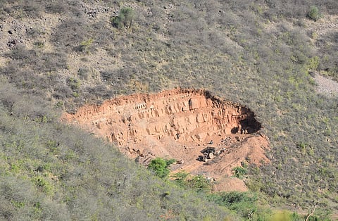
The committee was tasked with evolving a scientific definition to curb illegal mining, which has proliferated for decades across Rajasthan, Haryana, Gujarat and parts of Delhi due to ambiguous interpretations of what constitutes the Aravallis.
According to the report, the Aravalli landscape comprises around 58 per cent agricultural land, 11 per cent wooded areas, 6-7 per cent residential zones, about 2 per cent water bodies, and nearly 20 per cent protected forests, including four tiger reserves and close to 20 wildlife sanctuaries, where mining is already prohibited.
The definition accepted by the Supreme Court identifies an area as part of the Aravalli hills or ranges if it rises at least 100 metres above the surrounding terrain. The committee said this geological threshold was intended to bring uniformity to enforcement and prevent arbitrary exclusions. Applying this criterion, it found that nearly 90 per cent of the Aravalli landscape falls outside any potential mining consideration, as it comprises agricultural land, settlements, forests, water bodies and protected areas.
The report also stipulates that two hill ranges separated by more than 500 metres of plain terrain will be treated as distinct formations, a measure aimed at preventing isolated outcrops from being artificially linked to justify wider mining activity.
Importantly, the committee recommended that any mining—where legally permissible—must be preceded by a Management Plan for Scientific Mining (MPSM) to be prepared by the Indian Council of Forestry Research and Education (ICFRE). Acting on this recommendation, the Supreme Court has directed that no new mining leases be issued until the plan is finalised, effectively freezing expansion.
Officials also clarified that Rajasthan’s existing definition of the Aravallis remains intact, under which no mining is permitted in the hills or their supporting slopes below 100 metres down to ground level. The supporting slope is determined by the lowest contour line, and all areas enclosed within this contour are treated as part of the hill and remain protected.
Environmental groups and civil society organisations argue that the government’s assurances overlook a larger concern—that the Aravallis are being viewed primarily through a mining-control lens rather than as a living ecological system.
“The Aravallis are not just a collection of hills—they are a critical groundwater recharge zone, a climate buffer for the NCR and a biodiversity corridor,” campaigners said, warning that any definition allowing even limited mining risks legitimising future dilution under political or economic pressure.
Critics also point to the vulnerability of revenue land, degraded forests and privately owned tracts, which fall outside statutory forest protection and have historically been the first to be mined or converted. Weak enforcement in Rajasthan and Haryana, they say, compounds the risk.
While the top court has barred new mining leases for now, activists caution that the proposed scientific mining plan could later become a gateway for reopening extraction, particularly if executive discretion outweighs ecological safeguards. “The danger lies not in what is allowed today, but in what becomes possible tomorrow,” one campaigner said.
Concerns have also been raised over limited public consultation in defining the Aravallis, with local communities, independent ecologists and civil society largely absent from the process.
In a statement issued on December 22, the Aravalli Virasat Jan Abhiyaan flagged what it described as inconsistencies in the government’s public messaging. The group pointed to differences between statements made by the environment minister and a Bharatiya Janata Party press note dated December 21.
With regards to the Aravallis extending across 37 districts over about 1.44 lakh sq km, with 0.19 per cent (277.89 sq km) under legal mining permits, the minister referred to 39 districts, a total area of 1.47 lakh sq km, and said mining could occur in 217 sq km (around 2 per cent). The group said such discrepancies undermine public confidence and demanded clarity.
The Abhiyaan called on the MoEFCC to publicly disclose the exact number and names of Aravalli districts across Delhi, Haryana, Rajasthan and Gujarat; release data on the number of hills and total Aravalli area under both the earlier FSI definition and the new 100-metre criterion; and assure that all Aravalli hills will be protected irrespective of height.
It also criticised the government’s press note for highlighting the Aravallis mainly as a repository of historical and cultural sites, while omitting references to their biodiversity, forests, rivers, streams and dependent communities.
Questioning the government’s claim that over 90 per cent of the Aravallis will remain unaffected by the Supreme Court order, the group demanded immediate public consultations across all Aravalli blocks in Gujarat, Rajasthan and Haryana to explain how the new definition would strengthen—rather than weaken—conservation.
The government maintains that the uniform definition closes loopholes that enabled rampant illegal mining. Critics counter that without a landscape-level conservation law for the Aravallis, regulatory fixes tied narrowly to mining will remain inadequate.
As implementation unfolds, observers say the real test will be whether ecological protection prevails over extractive and real estate pressures in one of north India’s most degraded yet indispensable natural systems.