
Subscribe

The committee tasked by the Supreme Court with defining the Aravalli hills, knew the methodology it was using was faulty. However, it was forced to use the same measurement method currently adopted by the Aravalli states as the apex court insisted on a ‘uniform’ definition.
According to the panel report titled Uniform definition of Aravalli Hills and Ranges, the members assessed the slope and elevation method to define the Aravallis. They were aware of risks posed by inclusion and exclusion errors in the selection of the Aravallis across the four states of Gujarat, Rajasthan, Haryana and Delhi.
On the basis of a writ petition, the Supreme Court on May 5, 2024, had directed the Union Ministry of Environment, Forest and Climate Change (MoEFCC) to constitute a panel tasked with formulating a uniform definition of the Aravallis.
Representatives from MoEFCC, state forest department officials, Forest Survey of India (FSI), Central Empowered Committee (CEC) and Geological Survey of India (GSI) constituted the panel. They deliberated several times over the months to come out with a definition.
The focus of these deliberations was the rationale and feasibility of prescribing a uniform criterion for slope and elevation in defining the Aravallis, the report noted.
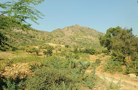
The officials calculated elevation from Mean Sea Level (MSL) across each of the 34 districts identified as being in the Aravalli range by the GSI. The minimum, maximum and average elevations were also calculated for each hill in the Aravalli districts, the report said.
Though ‘average elevation’ is a broader indicator for a hill, the Aravallis are an exception as the analysis found wide variations in average elevation across districts.
“Therefore, elevation parameter as a sole criterion cannot suffice the purpose as taking the average elevation for defining Aravalli Hills and Ranges will lead to inclusion and exclusion error for selection in the four states. This limitation arises from the considerable internal variation in terrain, coupled with the presence of similar topographic features in adjoining non-Aravalli areas too,” the officials noted.
Further, the slope analysis of the same 34 districts also showed considerable heterogeneity. The report noted that some districts have a hilly terrain that does not belong to the Aravallis.
“A significant part of these districts has non-Aravalli land lying within the identified districts, and this substantial extent highlights the risk of inclusion errors if slope alone is used for boundary demarcation,” it observed.
Noting that these parameters alone are inadequate to delineate boundaries, the committee noted, “Using only elevation and slope as criteria to demarcate the boundary of the Aravalli Hills and Ranges may lead to inclusion errors, as a significant part of hilly area falling within the identified districts is non-Aravalli. The entire geological extent of the Aravalli Ranges is not uniformly Hilly. In other words, not every part of the Aravalli is a Hill, and not every Hill is part of the Aravalli.”
A uniform definition of the Aravalli hills and ranges couldn’t be arrived at and while the deliberations were in progress, the SC on August 12, 2025 observed, “In some of the States, where the restriction was that the mining could not be permitted beyond 100 mt., the Hills were permitted to be mined up to the height of 100 mt. from all the four sides, leaving the remaining part as a pillar, which was susceptible to collapse at any point of time.”
“We do not understand as to why a period of more than two months is required for arriving at a policy decision, which can be taken by the Secretary of the MoEFCC by taking on board the representatives of all the State Governments,” the court said, adding that it was interested in protecting the precious Aravalli hills and ranges and prevent further damage.
If uncontrolled mining activities are permitted like what is going on at the present, it will be a great threat to the ecology of the nation, the apex court said.
As a single uniform definition could not be agreed upon, the state governments were roped in to understand their definition of the Aravalli hills and ranges in the context of mining.
According to the details furnished by the Rajasthan government, the identification of Aravalli Hills was done in accordance with Richard Murphy’s land reforms classification (1968) which involved landforms above 100 metres in height from the local relief or the bottom contour were considered as Aravalli hills in every district.
The Rajasthan definition was repurposed.
It stated that no mining is allowed in these hills, including their supporting slope below the 100 m part up to ground level. “The definition has two components; one is the Hills rising 100 m or above and second is the supporting slope below 100 m up to the ground level. The extent of supporting slope below 100 m height is decided by the bottom contour (local relief) and all the areas encircled by the bottom complete contour is treated as supporting slope and is included in the area of the Hill,” it said.
Gujarat also shared the same definition in agreement of Rajasthan, while Haryana also followed the same with additional consideration of the age of the mountains.
“No mining activity is carried out in the Delhi Ridge, neither is any mining lease granted,” the Delhi government said.
The panel, while taking note of the ecological importance of the hills and ranges, observed that the region was also a crucial repository of base metals such as lead, zinc, and copper, as well as precious and strategic minerals including gold and tungsten.
“In addition, the Aravalli-Delhi system has been identified as having significant potential for critical minerals such as tin, graphite, molybdenum, niobium, nickel, lithium, and rare earth elements (REEs), all of which are of growing strategic relevance for energy transition, high-technology manufacturing, and national security,” the report said.
After detailed deliberations, the committee felt that considering the wide variability of the elevation from Average Mean Sea Level (ASML), maybe the more appropriate and objective criterion for the Aravalli hills and ranges should be the elevation with reference to local relief, as already being followed for conservation and management of the Aravallis, the report said.
It finalised the definition as Any landform located in the Aravalli districts and having an elevation of 100 metres or more from the local relief, shall be termed as Aravalli Hills. For this purpose, the local relief shall be determined with reference to the lowest contour line encircling the landform. The entire landform lying within the area enclosed by such lowest contour, whether actual or extended notionally, together with the Hill, its supporting slopes and associated landforms irrespective of their gradient, shall be deemed to constitute part of the Aravalli Hills.
