
Subscribe

India is turning to heliborne Time Domain Electromagnetic surveys to confront a deepening groundwater crisis, especially in arid and over‑exploited regions.
By reading underground electrical signatures from the sky, scientists at unprecedented speed can map aquifer depth, thickness, quality and paleochannels.
These can guide precise recharge projects and shift policy from blind drilling to informed groundwater stewardship.
Somewhere beneath the cracked fields of Rajasthan, groundwater flows silently through the aquifers at depth, invisibly, as it has for millennia. Such aquifers hold the key to drinking water for hundreds of thousands of people who have depended on them for ages.
Now, with rising groundwater extraction and limited recharge because of low rainfall, the villagers are watching their wells go dry. Groundwater remains in limited quantity in the aquifers underneath the arid landscape, and it has always remained a challenge to locate the potential aquifers in such an agro‑climatic zone.
India’s groundwater crisis has long been defined by a brutal arithmetic: with about 240 billion cubic metres of extraction, the country is the largest extractor of groundwater in the world. Nearly 60 per cent of all irrigation, around 85 per cent of rural drinking water, and more than 50 per cent of urban water demand is met from groundwater.
Yet for most of modern history, the method for finding groundwater has remained almost medieval in its simplicity dig a well or drill a borewell. With time, hydrogeological mapping and surface geophysical techniques have come in as support. However, in complex geological terrains layered with clay, sand, hard rock and pockets of brine, these techniques have often proved inadequate and slow in execution.
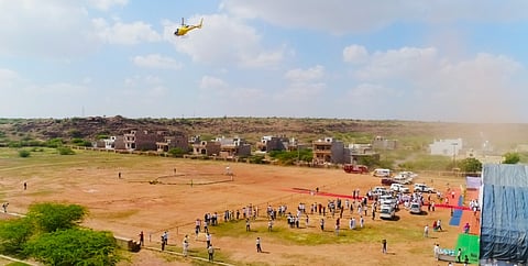
A quiet revolution is now taking place in targeting groundwater in the toughest of terrains. The Central Ground Water Board (CGWB), under the Union Ministry of Jal Shakti (water resources), Government of India, has deployed heliborne geophysical surveys across some of India’s most water‑stressed landscapes for mapping aquifers at a speed and resolution that conventional methods could never match.
To locate groundwater or find suitable groundwater recharge sites, the technology does not dig or drill. It simply reads the earth’s hidden electrical and conductivity signatures from the sky; teams of Geophysicists, Hydrogeologists and GIS experts then interpret these geophysical signals into the hydrogeological insights.
Every subsurface material saturated sand, dense clay, fractured basalt, saline water, fresh groundwater conducts electricity differently. Heliborne Time Domain Electromagnetic (TDEM) systems exploit this fact. Sensors suspended beneath a helicopter emit precisely controlled pulses of electromagnetic energy into the earth and measure the return signals as they decay.
From these responses, scientists reconstruct high‑resolution, three‑dimensional images of what lies below, such as aquifer thickness, depth,water quality, and the geometry of buried hydro‑geological features without disturbing a single grain of soil.
The scale advantage over conventional surveys is staggering. Where traditional hydrogeological fieldwork might take months to characterize a few square kilometers with hydrogeological survey, vertical electrical soundings and scattered borehole logs, a heliborne system can cover thousands of square kilometers in weeks, generating continuous subsurface data along every flight line.
The different geological layers can be precisely delineated laterally and vertically, and with some validation against borewell lithology and pumping data, potential aquifers emerge even in the most difficult terrains and geologic conditions.
CGWB’s first major proof of concept on TDEM came in the Ganga–Yamuna Doab, a region celebrated for agricultural productivity but increasingly notorious for collapsing groundwater tables. Between 2016 and 2018, a project of heliborne surveys funded by CGWB and executed through NGRI Hyderabad covered approximately 1,200 sq km around Prayagraj, targeting what scientists suspected but could not confirm: The existence of paleochannels of the river courses buried under millennia of alluvial sediment.
The river was clearly delineated in the electromagnetic data ghostly outlines of a river that had shifted course thousands of years ago, its coarse‑grained sand deposits still preserved beneath the flood plains of the Ganga. These paleochannels form natural underground reservoirs, highly potential and filled with good‑quality freshwater.
Encouraged, CGWB expanded the survey between 2019 and 2021 to cover nearly 8,500 sq km from Prayagraj to Kanpur, mapping other paleochannels, aquifers and buried drainage networks across the heart of the Ganga plains. The findings redrew the hydrogeological map of one of India’s most intensively cultivated and critical agricultural belts.
If the Ganga plains demonstrated the technology’s diagnostic power, western India showcased its ambition. In 2021–22, CGWB launched one of the world’s largest groundwater‑resource‑targeting heliborne programmes, an undertaking that swept across arid and semi‑arid terrain in parts of Rajasthan, Gujarat and Haryana states.
The numbers tell their own story: 97,165 square kilometres surveyed, 40,313-line kilometres flown by helicopter, 92 administrative blocks covered. In regions where a single failed borewell can devastate a farming family or leave a whole village starved for drinking water, this level of precision intelligence is transformative.
The surveys mapped aquifer geometry and thickness, located boundaries between fresh and saline groundwater, identified desaturated zones where overextraction has hollowed out the aquifer, and pinpointed buried paleochannel networks that could serve as recharge corridors for future water conservation efforts.
Crucially, the data were not filed away in a government archive. Processed findings were interpreted down to the Gram Panchayat level along survey lines, and district authorities in all three states received block‑level groundwater reports with practical recommendations — where to site recharge shafts, where to build check dams, where drilling would be productive, and, just as importantly, where it would not.
India’s groundwater predicament has two faces. In Punjab, Haryana and parts of the Indo‑Gangetic Plain, decades of subsidised electricity and minimum support prices for water‑intensive crops have driven extraction so deep that satellite gravity measurements by NASA’s GRACE mission have recorded measurable drops in the water table. In the arid west, the problem is different but more acute: not enough recharge, too much salinity, and a fragile balance between what nature replenishes and what we withdraw.
Heliborne surveys address both faces. By revealing exactly where freshwater sits, how deep the aquifer extends, and where natural recharge pathways exist, they allow planners to design Managed Aquifer Recharge (MAR) interventions with surgical precision rather than intuition. As monsoon patterns grow more erratic under climate change, the ability to bank percolated rainwater underground and to know exactly where the underground bank has capacity — becomes a strategic imperative, not just a technical nicety.
What CGWB is assembling, survey line by survey line, is something that has never existed before: a scientific atlas of India’s subsurface water resources. Combined with satellite remote sensing, hydrogeological modelling and local monitoring data, it promises to shift groundwater governance from reactive crisis management to proactive resource stewardship.
The paradigm shift is worth pausing on. For most of independent India’s history, groundwater policy has followed the logic of the borewell: identify stress, drill deeper, extract more. That approach has reached its physical and ecological limits in large parts of the country. The heliborne programme represents a different logic: understand the system, and then manage it. The programme outputs empower stakeholders and policy makers with precise data and system understanding so that the resource can be used more sustainably.
In the skies above Rajasthan’s dunes, Gujarat’s flatlands, and the intensively cultivated Ganga plains, a helicopter trailing a ring of sensors is doing something quietly extraordinary. It is finding the buried rivers and aquifers that cartographers never drew. It is measuring water that no gauge has ever recorded. And it is, perhaps for the first time, giving India the knowledge, it needs to protect the resource its people cannot live without.
Shashi Kant Singh, Anirudh Singh, KP Singh and TBN Singh are with the Central Ground Water Board. Dipankar Saha is with MRIIRS, Faridabad; formerly with Central Ground Water Board. Views expressed are the author’s own and don’t necessarily reflect those of Down To Earth.