
Monsoon 2025 saw 14 western disturbances, far higher than usual for the season.
Extra-tropical storms intensified rainfall and triggered flash floods in Himachal Pradesh and Uttarakhand.
Scientists link the anomaly to Arctic and West Asian warming, shifting jet streams northwards.
Expert warns India may be conflating cyclonic systems with western disturbances, signalling complex new risks.
The Southwest Monsoon (SWM) season of 2025 witnessed a much higher number of western disturbances than usual, which may have contributed to several extreme rainfall and flash flood events in the Himalayas.
Western disturbances are typically more common in the winter and spring months in India but have been occurring with increasing frequency during the summer and monsoon seasons, a trend linked to global warming and consequent climate change.
Between June 1, 2025 and August 20, 2025, India was impacted by 14 western disturbances, according to India Meteorological Department (IMD) data analysed by Down To Earth (DTE). Five of these extra-tropical storms in the middle to upper layers of the troposphere occurred in June, five in July and four in August (up to August 20). At least four of them were strong and persistent, lasting between five and seven days. The longest persisted for seven days, from June 12 to 18.
Ordinarily, India experiences four to six western disturbances on average between December and March. In the summer and monsoon months, their frequency drops to a minimum because the subtropical westerly jet stream — which carries these extra-tropical systems — shifts north of its normal position.
When western disturbances occur alongside the monsoon trough, which is an elongated low-pressure area around which rainfall develops during the monsoon, their interaction can lead to catastrophic events such as the Uttarakhand flash floods of 2013. The floods had claimed more than 5,000 lives.
However, the frequency of western disturbances during the summer and monsoon months has been rising in recent decades, influenced by the shifting position of the subtropical westerly jet stream due to Arctic warming, according to a DTE analysis.
A cloudburst-type rainfall event triggered a flash flood in Mandi town, Himachal Pradesh, on the night of July 28-29, 2025, killing three people. At the time, a western disturbance was present over Afghanistan and Pakistan, moving across Jammu & Kashmir and Himachal Pradesh by July 29. Even from a distance, western disturbances can intensify rainfall in the western Himalayas by inducing cyclonic circulations and storms in the lower layers of the atmosphere across neighbouring regions.
During this period, the monsoon trough was in its normal position, when its influence on Himalayan rainfall is generally weaker than when it shifts northwards.
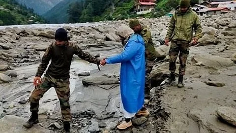
On August 5, a sudden and intense flash flood hit Dharali and Harshil villages in Uttarkashi district, Uttarakhand, leaving four people dead and about 100 missing. A western disturbance was active over Jammu & Kashmir at the time, and the western end of the monsoon trough lay north of its normal position.
Raghu Murtugudde, professor of climate studies at the Indian Institute of Technology, Bombay, contended that some of these extra-tropical cyclonic circulations may originate closer to India than the western disturbances that usually form in the Mediterranean and move eastward towards the country.
“There are probably more cyclonic systems coming from the west, but their origin may not be as far as the Mediterranean. This needs to be studied more carefully. I think they are being born over Pakistan or slightly further west, due to interactions between the westerlies north of the monsoon circulation and the northward flow from the Arabian Sea, which is now extending further north,” Murtugudde told DTE.
“The warming of West Asia and the Mediterranean is pulling the northern edge of the low-level jet — or the southwesterlies — further north and more frequently than the natural variability of the jet stream would,” he added.
The low-level jet, a band of strong winds in the upper atmosphere, plays a key role in rainfall over India during the SWM season. Its position determines where, and how much, rain will fall across India at any given time.”
“These are the winds pumping moisture into the Himalayan foothills, fuelling flash floods and cloudbursts. They are also driving more heavy rainfall over Mumbai, Gujarat, northwest India and Pakistan. We are probably conflating these phenomena with western disturbances,” Murtugudde concluded.