
Subscribe

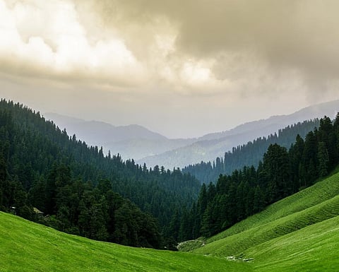
There has been an increase in forest loss in India’s mountainous states along its Himalayan frontier, which are already in the throes of climate change, according to the latest report by the Forest Survey of India (FSI).
India’s State of Forest Report is a biennial publication. The report for 2021 was released by Union Minister for Environment, Forest and Climate Change, Bhupender Yadav January 13, 2022.
The report has classified India’s forests into four categories. One of them is Very Dense Forest (with tree canopy density of 70 per cent or above).
The Union territory (UT) of Jammu and Kashmir, which had very dense forests of 4,270 square kilometres (sq km) area in 2019, had 4,155 sq km of the same forest category in 2021. This is the highest loss of very dense forests anywhere in India.
Another category of forest as defined in the report is Open Forest (tree canopy density of 10 per cent or above but less than 40 per cent).
Jammu and Kashmir has lost very dense forests but gained open forests, according to the report. This has led to an increase in the UT’s total forest area to 21,387 sq km in 2021, from 21,358 in 2019. The increase in open forests is led by commercial plantations.
The total forest area of Himachal Pradesh, another mountainous state, has increased by 9 sq km. But there has been loss of open and Moderately Dense Forest (tree canopy density of 40 per cent or above but less than 70 per cent). Moderately dense forests are usually close to human habitations.
Himachal Pradesh had an area of 7,126 sq km under moderately dense forests in 2019. This reduced to 7,100 sq km in 2021. The state had open forests spread across 5,195 sq km of its area in 2019. This reduced to 5,180 sq km in 2021.
The report has attributed the loss of forest cover in the Himalayas and North East to an increase in developmental activities as well as agriculture.
Read more:
The report has also mapped climate change hotspots in Indian forests, based on projections for 2030, 2050 and 2080.
It predicted that Himalayan states and UTs like Ladakh, Jammu and Kashmir, Himachal Pradesh and Uttarakhand will record the maximum increase in temperature and also possibly experience decrease in rainfall.
Extreme rainfall may also increase in the states of the North East.
Pan-India scenario
India’s forest cover increased by 1,540 sq km and its tree cover rose by 721 sq km, according to the report. The total forest area in the country is 713,789, which is 21.27 per cent of the country’s land area. This figure was 712,249 sq km in the 2019 report.
India’s moderately dense forest area decreased by 1,582 sq km to 306,890 sq km in 2021, from 308,472 sq km in 2019.
Odisha lost the most area under moderately dense forest. It decreased to 20,995 sq km in 2021, from 21,552 sq km in 2019. Odisha ranks among the top five states in India in terms of increase in total forest area.
Five Indian states where total forest area has increased
| State | Total Forest Area 2021 | Total Forest Area 2019 | Increase (in sq km) |
| Andhra Pradesh | 29,784 | 29,137 | 647 |
| Telangana | 21,214 | 20,582 | 632 |
| Odisha | 52,156 | 51,619 | 537 |
| Karnataka | 38,730 | 38,575 | 155 |
| Jharkhand | 23,721 | 23,611 | 110 |
Five Indian states where total forest area has decreased
| State | Total Forest Area 2021 | Total Forest Area 2019 | Decrease (in sq km) |
| Arunachal Pradesh | 66,431 | 66,688 | 257 |
| Manipur | 16,598 | 16,847 | 249 |
| Nagaland | 12,251 | 12,486 | 235 |
| Mizoram | 17,820 | 18,006 | 186 |
| Meghalaya | 17,046 | 17,119 | 73 |
The area under very dense forest in India increased by 501 sq km and open forest area by 2,621 sq km as compared to 2019. The very dense forest area of the country in 2019 was 99,278 sq km. This increased to 99,779 sq km in 2021.
The open forest area was 304,499 sq km in 2019, which has increased to 307,120 sq km in 2021.
Three southern states (Andhra Pradesh, Telangana and Karnataka) and two eastern states (Odisha and Jharkhand) have recorded the highest increase in forest cover.
States in the North East have recorded the highest loss in forest cover.
There has been a reduction in the total forest are of Delhi too (.44 sq.km). The total forest area of Delhi in 2021 was found to be 195 sq km. Mostly open forest area has been damaged.
India had 4,992 sq km of mangroves in 2021, which was an increase of 17 sq km.
