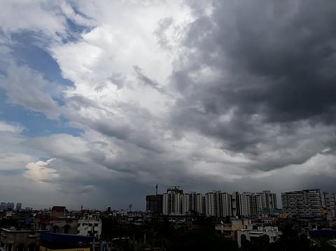

A low pressure area may form over the southwestern parts of the Bay of Bengal around May 22 and intensify into a depression by May 24, according to the India Meteorological Department (IMD).
This may influence the progress of the monsoon winds, which are currently over south Andaman Sea and south Bay of Bengal. In turn a swift progress of the monsoon winds may also lead to the destabilisation of the cyclone.
If the cyclone (which would be named Remal) does form, it would be the first of the pre-monsoon season of 2024. Cyclones may not have formed in the preceding two months due to various climatic phenomena in the region, such as an inactive Madden Julian Oscillation (MJO), presence of anti-cyclones and lack of typhoon activity in the western Pacific Ocean, which sends remnants into the Bay of Bengal that can possibly intensify into cyclones.
At the outset, the lack of cyclones may seem like a positive thing as cyclones can be devastating for coastal communities. Many pre-monsoon cyclones in the past few years have grown to extreme intensities, with record-breaking winds and heavy rainfall.
Extremely severe cyclone Fani in early May 2019 and super cyclone Amphan in late May 2020 in the Bay of Bengal and extremely severe cyclone Tauktae in May 2021 in the Arabian Sea caused significant damage to infrastructure and disrupted the lives of coastal people. While Fani had peak wind speeds of 230 km / hr wind speeds of Cyclone Amphan went up to 270 km / hr.
The late genesis of a cyclonic system in the run up to the southwest monsoon or around its onset could translate into a weak or late onset of monsoon over Kerala or block progress in the rest of the country.
This happened in 2019 and 2023. In both years, the onset of the monsoon over Kerala happened on June 8 against the normal date of June 1. In both years, cyclones had formed around the onset of the monsoon. In 2019, Cyclone Vayu formed on June 10, while in 2023, Cyclone Biparjoy formed on June 6. The month of June in 2019 was much drier than normal.
“Cyclogenesis is tricky. Not many seeds were put down due to the anticyclones in the past couple of months and now the Bay of Bengal is exploding,” Raghu Murtugudde, professor of climate studies at the Indian Institute of Technology, Bombay and emeritus professor at the University of Maryland, told Down To Earth.
On the contrary, it could also mean a rapid progress of monsoon and early floods in many states, and then slow progress in the rest of the country after that, like what happened in 2021.
Back to back cyclones Tauktae in the Arabian Sea and Yaas in the Bay of Bengal propelled the monsoon winds over India but then the monsoon stalled for over three weeks.
The reasons for there being no formation of cyclones in the north Indian Ocean region is the inactivity of the MJO and lean typhoon season in the western Pacific Ocean, according to the blog Vagaries of the Weather.
MJO is a climate phenomenon in which a region of clouds, storms and rainfall passes from west to east along the equator. These small storms often act as seeds for the genesis of low pressure areas, which intensify into cyclones if other weather parameters are also conducive.
Some of these factors are higher than normal sea surface temperatures, presence of moisture and less vertical wind shear, which generally leads to the dissipation of cyclones.
The MJO, unlike the more stable El Nino phenomenon in the equatorial Pacific Ocean, varies every week and has eight phases depending on the geographical region where the pulses of rains and storms are located.
In each of these phases, storminess is observed in different regions along the equator. During phases 2, 3 and 4 of MJO, storm and rain activity is observed in the Indian Ocean region.
In its press release from May 2, IMD had stated that in the following couple of weeks MJO would go from phase 4 to phase 1, which meant that storms and rainfall would elude the north Indian Ocean region till at least the first half of second week of May.
On May 16, IMD stated that MJO was in Phase 3 and would go into Phase 4 from May 18 and remain the same for the following two weeks with a large amplitude (which means more intense pulses of storms and rainfall).
It also said: “Thus MJO, phase and amplitude are highly favourable for enhancement of convective activity and hence cyclogenesis over the Bay of Bengal during the entire forecast period.”
“MJO is moving to the south of Bay. These winds provide a rotational trigger for the cyclones to initiate,” wrote climate scientist Roxy Mathew Koll on the social media platform Facebook.
“I am not sure if MJO is the cause or the effect for cyclones since the anticyclones have been dominating. When the seeds germinate into storms is nearly impossible to predict,” said Murtugudde.
Another source of seeds for the generation of cyclones are the remnants of typhoons in the western Pacific Ocean, which cross over to the Bay of Bengal and intensify into cyclones. But typhoon activity in the western Pacific has been one of the leanest on record, according to the media.
One reason for the less than normal typhoons in the western North Pacific Ocean could be the presence of an anticyclone over the region, which was also observed in July 2020.
In a research paper published in the journal Geophysical Research Letters in April 2021, scientists pointed out that sea surface temperature anomalies in the Indian Ocean were the reason behind the presence of an anti-cyclone over the western North Pacific Ocean, which lead to the lack of typhoon development.
“Oceans are too warm and the anticyclones tend to cause convergence and warming in the oceans as well. Winds have to shift as we get close to the onset of the monsoon and that provides a fertile ground for seeds to germinate and grow. Let’s see how strong it gets,” explained Murtugudde.
“Good news is that the stretch is always small in the north Indian Ocean and thus the cyclones do not get monstrous like hurricanes and typhoons,” he added.
“The restricting factor (for the cyclone) could be a quick northward progression of the monsoon, suppressing the vertical formation of the cyclone. If that’s the case, this will end up as a monsoon depression bringing rains. Otherwise, it could develop into a weak cyclone of a short duration,” wrote Koll.