
Subscribe


Climate change behind increasing variability and unpredictability of rainfall in the region, say experts
Click here to read more

Over the past century or so, rainfall in the region, along with the flood-drought cycle, has changed character for the worse. The phenomenon has picked up pace in recent years
Click here to read more

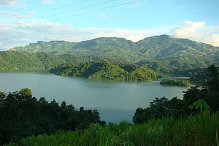
DTE analyses geography of 8 northeastern states and shows what changing climate and rainfall patterns mean for the region
Click here to read more

Drying up of water springs, land degradation, sandy soils of the Brahamputra point to a grim situation in the region
Click here to read more

The Kumutiya river floods every year, destroying crops and houses. The river has shifted 3 km since 1960, and an entire village has had to shift with it
Click here to read more

Nagaland’s Wokha district experienced at least 3 heavy-to-very heavy rainfall events in 2018
Click here to read more

Overall rainfall and rainy days in Assam’s Golaghat district have decreased, but heavy rainfall days have increased
Click here to read more

From Bhalukpong on border of Arunachal Pradesh and Assam to Morgung village in West Kameng district, at least 10 major mountain springs have dried up, DTE observed
Click here to read more

Increased rainfall leads to decline in rice productivity: New diseases have emerged, pest attacks on the rise
Click here to read more